Le Café Turenne
Le Café Turenne is a café in Sedan, Ardennes, Grand Est. Le Café Turenne is situated nearby to the ruins Ancienne Chapelle du Château, as well as near Sedan Castle.| Tap on a place to explore it |
- Opening hours: Saturday and Sunday 6:00 PM—9:00 PM
- Type: Café
- Wheelchair access: no
Places of Interest Nearby
Highlights include Sedan Castle and Saint-Charles-Borromée church in Sedan.
Sedan Castle
Castle
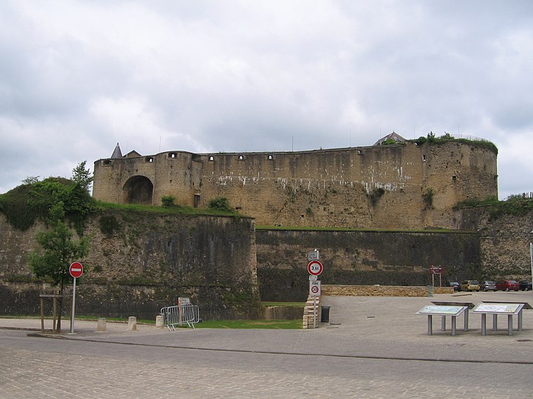
Photo: Michiel1972, CC BY-SA 3.0.
Sedan Castle is a castle situated in Sedan, France, near the river Meuse. Covering an area of 35,000 square metres in its seven floors.
Saint-Charles-Borromée church in Sedan
Church

Photo: MOSSOT, CC BY-SA 3.0.
Saint-Charles-Borromée church in Sedan is situated 200 metres southwest of Le Café Turenne.
Sedan Synagogue
Synagogue

Photo: Wikimedia, Public domain.
The Sedan Synagogue is a former Jewish congregation and synagogue, located at 6, avenue de Verdun, Sedan, in the Ardennes department of the Grand Est region, in northern France. Sedan Synagogue is situated 320 metres south of Le Café Turenne.
Places in the Area
Nearby places include Sedan.
Sedan
Town
 Sedan is a sub-prefecture and the second most populous city in the Champagne-Ardenne region in France. Sedan is known for its castle, which is claimed to be the largest fortified medieval castle in Europe. It is home to about 17,000 people.
Le Café Turenne
- Location: Sedan, Arrondissement of Sedan, Ardennes, Grand Est, France, Europe
- View on OpenStreetMap
Latitude
49.70173° or 49° 42′ 6″ northLongitude
4.94924° or 4° 56′ 57″ eastOpen location code
8FX6PW2X+MMOpenStreetMap ID
node 1628897575OpenStreetMap feature
amenity=cafeOpenStreetMap attribute
wheelchair=no
This page is based on OpenStreetMap, Wikidata, and Wikimedia Commons.
We’d love your help improving our open data sources. Thank you for contributing.
Satellite Map
Discover Le Café Turenne from above in high-definition satellite imagery.
Notable Places Nearby
Highlights include Ancienne Chapelle du Château and Panorama de Sedan.
Nearby Places
Explore places such as La Tour d’Auvergne and Teau Fort de Sedan.
Grand Est: Must-Visit Destinations
Delve into Strasbourg, Reims, Metz, and Nancy.
Curious Cafés to Discover
Uncover intriguing cafés from every corner of the globe.
About Mapcarta. Data © OpenStreetMap contributors and available under the Open Database License". Text is available under the CC BY-SA 4.0 license, except for photos, directions, and the map. Photo: Tftx, CC BY 3.0.