Venta Restaurante Los Molinos
Venta Restaurante Los Molinos is a restaurant in Algodonales, Cádiz, Andalusia. Venta Restaurante Los Molinos is situated nearby to the power station Parque Solar Algodoliva, as well as near the cemetery Cemeterio Municipal de Algodonales.| Tap on a place to explore it |
Places of Interest Nearby
Highlights include Algodonales town hall and Iglesia de Santa Ana.
Algodonales town hall
Town hall

Photo: El Pantera, CC BY-SA 4.0.
Algodonales town hall is situated 2 km east of Venta Restaurante Los Molinos.
Iglesia de Santa Ana
Church

Photo: SergioBCN, Public domain.
Iglesia de Santa Ana is a church, which is situated 2 km east of Venta Restaurante Los Molinos.
Places in the Area
Nearby places include Algodonales and Zahara de la Sierra.
Algodonales
Village
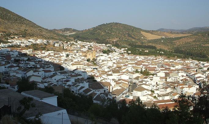
Photo: SergioBCN, Public domain.
Algodonales is a city and a Municipality, located in the province of Cádiz, Spain. According to the 2002 census, the city has a population of 5,607 inhabitants.
Zahara de la Sierra

Photo: Tango7174, CC BY-SA 4.0.
Zahara de la Sierra is in Cádiz Province in Andalucia. It is a small white village of 1,400 people that sits picturesquely on a mountain cone on the northern edge of the Sierra del Jaral.
El Gastor
Village

Photo: Wikimedia, CC BY-SA 3.0.
El Gastor is a city located in the province of Cádiz, Spain. According to the 2005 census, the city has a population of 1,948 inhabitants. El Gastor is situated 9 km east of Venta Restaurante Los Molinos.
Venta Restaurante Los Molinos
- Type: Restaurant
- Cuisine: regional
- Category: food
- Location: Algodonales, Cádiz, Andalusia, Spain, Iberia, Europe
- View on OpenStreetMap
Latitude
36.87762° or 36° 52′ 39″ northLongitude
-5.42541° or 5° 25′ 32″ westOpen location code
8C8PVHHF+2ROpenStreetMap ID
node 1632539717OpenStreetMap feature
amenity=restaurantOpenStreetMap attribute
cuisine=regional
This page is based on OpenStreetMap, Wikidata, and Wikimedia Commons.
We’d love your help improving our open data sources. Thank you for contributing.
Satellite Map
Discover Venta Restaurante Los Molinos from above in high-definition satellite imagery.
Notable Places Nearby
Highlights include Parque Solar Algodoliva and Cemeterio Municipal de Algodonales.
Nearby Places
Explore places such as Repsol and Venta El Cortijo.
Cádiz: Must-Visit Destinations
Delve into Cádiz, Jerez de la Frontera, Algeciras, and Tarifa.
Curious Restaurants to Discover
Uncover intriguing restaurants from every corner of the globe.
About Mapcarta. Data © OpenStreetMap contributors and available under the Open Database License". Text is available under the CC BY-SA 4.0 license, except for photos, directions, and the map. Photo: Wikimedia, CC0.