Col du Trayas
Col du Trayas is in Théoule-sur-Mer, Arrondissement of Grasse, Provence-Alpes-Côte d’Azur. Col du Trayas is situated nearby to the mountain saddle Col des Monges, as well as near the peak Sommet des Grosses Grues.| Tap on a place to explore it |
Places of Interest Nearby
Highlights include Gare de Théoule-sur-Mer and Gare du Trayas.
Gare de Théoule-sur-Mer
Railway station
 Gare de Théoule-sur-Mer is a railway station, which is situated 2½ km northeast of Col du Trayas.
Gare du Trayas
Railway station
 Gare du Trayas is a railway station, which is situated 2½ km south of Col du Trayas.
Pic de l’Ours
Peak
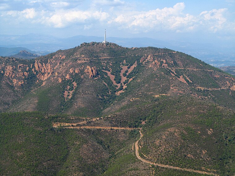
Photo: Prouzet, CC BY-SA 3.0.
Pic de l’Ours is a peak, which is situated 2½ km southwest of Col du Trayas.
Places in the Area
Nearby places include Théoule-sur-Mer and La Pointe de l’Aiguille.
Théoule-sur-Mer
Village

Photo: Wikimedia, CC BY-SA 3.0.
Théoule-sur-Mer, popularly known as Théoule, is a resort village in the Alpes-Maritimes department in the Provence-Alpes-Côte d'Azur region in Southeastern France.
La Pointe de l’Aiguille
La Pointe de l'Aiguille is a natural park next to the city of Théoule-sur-mer in the Alpes-Maritimes.Mandelieu-la-Napoule
Town

Photo: Wikimedia, CC BY-SA 3.0.
Mandelieu-la-Napoule is a commune in the Alpes-Maritimes department of the Provence-Alpes-Côte d'Azur region in Southeastern France. Located on the French Riviera, just to the southwest of Cannes and northeast of Théoule-sur-Mer, it had a population of 21,772 in 2020. Mandelieu-la-Napoule is situated 5 km north of Col du Trayas.
Col du Trayas
- Type: Sign
- Categories: information and tourism
- Location: Théoule-sur-Mer, Arrondissement of Grasse, Alpes-Maritimes, Provence-Alpes-Côte d’Azur, France, Europe
- View on OpenStreetMap
Latitude
43.49653° or 43° 29′ 48″ northLongitude
6.91754° or 6° 55′ 3″ eastElevation
245 metres (804 feet)Operator
Conseil Départemental des Alpes-MaritimesOpen location code
8FM8FWW9+J2OpenStreetMap ID
node 1641021012OpenStreetMap feature
tourism=information
This page is based on OpenStreetMap, Wikidata, and Wikimedia Commons.
We’d love your help improving our open data sources. Thank you for contributing.
Satellite Map
Discover Col du Trayas from above in high-definition satellite imagery.
Notable Places Nearby
Highlights include Col du Trayas and Col des Monges.
Nearby Places
Explore places such as Collet des Monges and Col de la Cadière.
Alpes-Maritimes: Must-Visit Destinations
Delve into Nice, Cannes, Antibes, and Menton.
Curious Places to Discover
Uncover intriguing places from every corner of the globe.
About Mapcarta. Data © OpenStreetMap contributors and available under the Open Database License". Text is available under the CC BY-SA 4.0 license, except for photos, directions, and the map. Photo: Myrabella, CC BY-SA 3.0.