Plattensteiglift-Bergstation
Plattensteiglift-Bergstation is an aerial lift in Lermoos, Reutte District, Tyrol. Plattensteiglift-Bergstation is situated nearby to Lermoos - Grubigstein, as well as near the playground Station - Baumhaus.| Tap on a place to explore it |
Places of Interest Nearby
Highlights include Lermoos railway station and Ortskapelle hl. Josef.
Lermoos railway station
Railway station
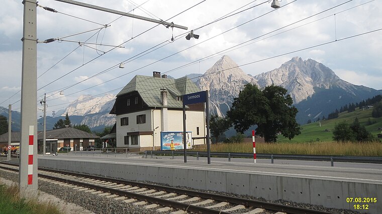
Photo: David Short, CC BY 2.0.
Lermoos railway station is situated 1½ km northeast of Plattensteiglift-Bergstation.
Ortskapelle hl. Josef
Church

Photo: HGT64, CC BY-SA 4.0.
Ortskapelle hl. Josef is a church, which is situated 1½ km north of Plattensteiglift-Bergstation.
Hotel Post
Hotel

Photo: Ricardalovesmonuments, CC BY 4.0.
Hotel Post is situated 1½ km northeast of Plattensteiglift-Bergstation.
Places in the Area
Nearby places include Gartnerwand and Ehrwald.
Gartnerwand
Locality

Photo: Sven Schefzyk, CC BY-SA 3.0.
Gartnerwand is a locality, which is situated 3½ km west of Plattensteiglift-Bergstation.
Ehrwald

Photo: Triplec85, CC BY-SA 3.0.
Ehrwald is a picturesque village in the Northwest Tyrol region of Austria. Nestled at the foot of the Zugspitze, Germany's highest peak, Ehrwald is a popular destination for outdoor enthusiasts year-round.
Lähn
Hamlet

Photo: Wikimedia, CC BY-SA 3.0.
Lähn is a hamlet, which is situated 4 km northwest of Plattensteiglift-Bergstation.
Plattensteiglift-Bergstation
- Type: Aerial lift
- Categories: station and transportation
- Location: Lermoos, Reutte District, Tyrol, Austria, Central Europe, Europe
- View on OpenStreetMap
Latitude
47.39148° or 47° 23′ 29″ northLongitude
10.86871° or 10° 52′ 7″ eastOpen location code
8FVG9VR9+HFOpenStreetMap ID
node 1684131862OpenStreetMap feature
aerialway=stationOpenStreetMap feature
public_transport=station
This page is based on OpenStreetMap, Wikidata, and Wikimedia Commons.
We’d love your help improving our open data sources. Thank you for contributing.
Satellite Map
Discover Plattensteiglift-Bergstation from above in high-definition satellite imagery.
Notable Places Nearby
Highlights include Lermoos - Grubigstein and Station - Baumhaus.
Nearby Places
Explore places such as Grubigalmbahn-Talstation and Grubig II Talstation.
Tyrol: Must-Visit Destinations
Delve into Innsbruck, Kufstein, Lienz, and Kitzbühel.
Curious Aerial Lifts to Discover
Uncover intriguing aerial lifts from every corner of the globe.
About Mapcarta. Data © OpenStreetMap contributors and available under the Open Database License". Text is available under the CC BY-SA 4.0 license, except for photos, directions, and the map. Photo: Traveler100, CC BY-SA 3.0.