Hornhaldenstrasse
Hornhaldenstrasse is a bus stop in Kilchberg (ZH), Horgen District, Canton of Zurich. Hornhaldenstrasse is situated nearby to the park Anlage Unterer Mönchhhof, as well as near Seeanlage.| Tap on a place to explore it |
Places of Interest Nearby
Highlights include Kilchberg railway station and Rote Fabrik.
Kilchberg railway station
Railway station
 Kilchberg railway station is a railway station in Switzerland, situated near to the banks of Lake Zurich in the municipality of Kilchberg, within fare zone 150 of the Zürcher Verkehrsverbund. Kilchberg railway station is situated 1 km southeast of Hornhaldenstrasse.
Rote Fabrik
Arts center

Photo: Parpan05, CC BY-SA 3.0.
Rote Fabrik is a former factory in the Wollishofen neighbourhood of Zurich, Switzerland. It is now used as a music venue and cultural centre. It is so named because the buildings are made of red brick, but also because left-wing parties were part of the campaign to turn the location into a cultural centre. Rote Fabrik is situated 1¼ km north of Hornhaldenstrasse.
Zurich Leimbach railway station
Railway station

Photo: NAC, CC BY-SA 4.0.
Zürich Leimbach is a railway station in the south-west of the Swiss city of Zurich, in the Leimbach quarter. It is located within fare zone 110 of the Zürcher Verkehrsverbund. Zurich Leimbach railway station is situated 2 km west of Hornhaldenstrasse.
Places in the Area
Nearby places include Kilchberg and Wollishofen.
Kilchberg
Village
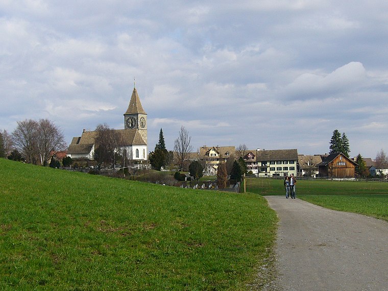
Photo: Wikimedia, CC BY-SA 3.0.
Kilchberg is a municipality in the district of Horgen in the canton of Zürich in Switzerland. Kilchberg is the site of a regional cemetery.
Wollishofen
Suburb
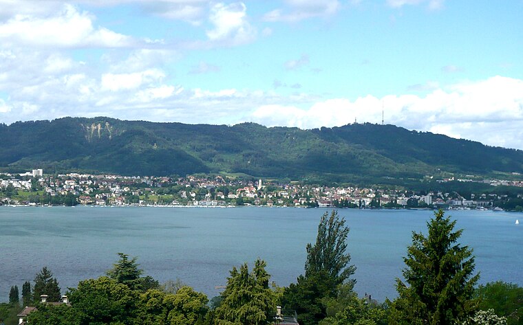
Photo: Parpan05, CC BY-SA 3.0.
Wollishofen is a neighbourhood in Zürich's 2nd district, situated in the eastern foothills of Uetliberg. It was formerly a municipality of its own, having been incorporated into Zürich in 1893.
Leimbach
Suburb

Photo: Roland zh, CC BY-SA 3.0.
Leimbach is a quarter in the district 2 in Zürich. It is located in the lower Sihl Valley. It was formerly a municipality of its own, having been incorporated into Zürich in 1893.
Hornhaldenstrasse
- Type: Bus stop
- Categories: transport stop and transportation
- Location: Kilchberg (ZH), Horgen District, Canton of Zurich, Switzerland, Central Europe, Europe
- View on OpenStreetMap
Latitude
47.33158° or 47° 19′ 54″ northLongitude
8.54223° or 8° 32′ 32″ eastElevation
455 metres (1,493 feet)Operator
Verkehrsbetriebe ZürichNetwork
Zurich Transport NetworkOpen location code
8FVC8GJR+JVOpenStreetMap ID
node 1685223170OpenStreetMap feature
highway=bus_stopOpenStreetMap feature
public_transport=stop_position
This page is based on OpenStreetMap, Wikidata, and Wikimedia Commons.
We’d love your help improving our open data sources. Thank you for contributing.
Satellite Map
Discover Hornhaldenstrasse from above in high-definition satellite imagery.
Notable Places Nearby
Highlights include Anlage Unterer Mönchhhof and Seeanlage.
Nearby Places
Explore places such as Hornhaldenstrasse and Kilchberg ZH, Weinbergstrasse.
Switzerland: Must-Visit Destinations
Delve into Zurich, Berne, Geneva, and Basel.
Curious Bus Stops to Discover
Uncover intriguing bus stops from every corner of the globe.
About Mapcarta. Data © OpenStreetMap contributors and available under the Open Database License". Text is available under the CC BY-SA 4.0 license, except for photos, directions, and the map. Photo: Wikimedia, CC0.