Glindwasenhütte
Glindwasenhütte is a shelter in Burladingen, Zollernalbkreis, Baden-Württemberg. Glindwasenhütte is situated nearby to the public building Obst- und Gartenbauverein, as well as near the peak Dreifürstenstein.| Tap on a place to explore it |
Places of Interest Nearby
Highlights include Dreifürstenstein and Bei der Olgahöhe.
Dreifürstenstein
Peak

Photo: Ramessos, Public domain.
Dreifürstenstein is a mountain in Zollernalbkreis, Baden-Württemberg, Germany.

Bergrutsch am Hirschkopf
Nature reserve

Photo: Kreuzschnabel, CC BY-SA 3.0.
Bergrutsch am Hirschkopf is a nature reserve.
Places in the Area
Nearby places include Mössingen and Talheim.
Mössingen
Town

Photo: UnreifeKirsche, CC BY-SA 3.0.
Mössingen is a town in the district of Tübingen, in Baden-Württemberg, Germany. It is situated north of the Swabian Jura, about 13 km south of Tübingen. Mössingen is situated 3 km north of Glindwasenhütte.
Talheim
Village

Photo: UnreifeKirsche, CC BY-SA 3.0.
Talheim is a village, which is situated 4 km east of Glindwasenhütte.
Bodelshausen
Village
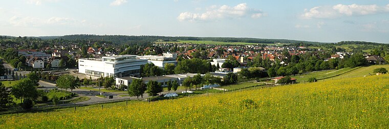
Photo: UnreifeKirsche, CC BY-SA 3.0.
Bodelshausen is a municipality in the district of Tübingen in the German state of Baden-Württemberg. Bodelshausen is situated 6 km west of Glindwasenhütte.
Glindwasenhütte
- Type: Shelter
- Location: Burladingen, Zollernalbkreis, Tübingen Region, Baden-Württemberg, Germany, Central Europe, Europe
- View on OpenStreetMap
Latitude
48.3816° or 48° 22′ 54″ northLongitude
9.04747° or 9° 2′ 51″ eastOpen location code
8FWF92JW+JXOpenStreetMap ID
node 1690552188OpenStreetMap feature
amenity=shelter
This page is based on OpenStreetMap, Wikidata, and Wikimedia Commons.
We’d love your help improving our open data sources. Thank you for contributing.
Satellite Map
Discover Glindwasenhütte from above in high-definition satellite imagery.
Notable Places Nearby
Highlights include Obst- und Gartenbauverein and Keltische Viereckschanze.
Nearby Places
Explore places such as Glindwasen and Buch.
Baden-Württemberg: Must-Visit Destinations
Delve into Stuttgart, Heidelberg, Karlsruhe, and Mannheim.
Curious Shelters to Discover
Uncover intriguing shelters from every corner of the globe.
About Mapcarta. Data © OpenStreetMap contributors and available under the Open Database License". Text is available under the CC BY-SA 4.0 license, except for photos, directions, and the map. Photo: Traveler100, CC BY-SA 3.0.