Montaña de la Culata
Montaña de la Culata is a peak in El Rosario, Santa Cruz de Tenerife. Montaña de la Culata is situated nearby to the suburb Barranco Hondo, as well as near the hamlet Las Barreras.| Tap on a place to explore it |
Places of Interest
Highlights include Mirador de Montaña Grande and Ermita Nuestra Senora de la Candelaria.
Mirador de Montaña Grande
Scenic viewpoint

Photo: Mike Peel, CC BY-SA 4.0.
Mirador de Montaña Grande is a scenic viewpoint.
Ermita Nuestra Senora de la Candelaria
Church

Photo: Mike Peel, CC BY-SA 4.0.
Ermita Nuestra Senora de la Candelaria is a church.
Candelaria Thermal Power Plant
Power station
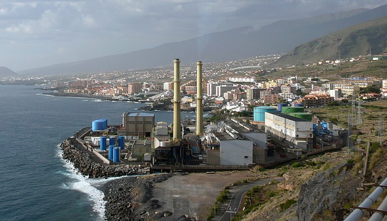
Photo: Jose Mesa, CC BY-SA 2.0.
Candelaria Thermal Power Plant is a power station.
Places in the Area
Nearby places include La Esperanza and Candelaria.
La Esperanza

Photo: Wikimedia, CC BY-SA 4.0.
La Esperanza is a town in Tenerife, the largest of the Canary Islands, Spain.
Candelaria
 Candelaria is a city on the east shore of the island Tenerife in the Canary Islands archipelago. It is a city of 28,000 inhabitants, best known for its basilica which includes the sculpture of the Virgin Mary and mural paintings.

Montaña de la Culata
- Type: Peak
- Category: landform
- Location: El Rosario, Santa Cruz de Tenerife, Canary Islands, Spain, Iberia, Europe
- View on OpenStreetMap
Latitude
28.4077° or 28° 24′ 28″ northLongitude
-16.3654° or 16° 21′ 55″ westOpen location code
7CW5CJ5M+3ROpenStreetMap ID
node 1697905885OpenStreetMap feature
natural=peak
This page is based on OpenStreetMap, Wikidata, and Wikimedia Commons.
We’d love your help improving our open data sources. Thank you for contributing.
Satellite Map
Discover Montaña de la Culata from above in high-definition satellite imagery.
Localities in the Area
Explore places such as Barranco Hondo and Las Barreras.
Notable Places Nearby
Highlights include Depósito Barranco Hondo I and Centro Cultural Municipal Cho Morrocoyo.
Canary Islands: Must-Visit Destinations
Delve into Santa Cruz de Tenerife, Las Palmas, La Palma, and La Gomera.
Curious Peaks to Discover
Uncover intriguing peaks from every corner of the globe.
About Mapcarta. Data © OpenStreetMap contributors and available under the Open Database License". Text is available under the CC BY-SA 4.0 license, except for photos, directions, and the map. Photo: Wikimedia, CC BY-SA 4.0.