La Guinèvre
La Guinèvre is a hamlet in Saint-Philbert-de-Grand-Lieu, Arrondissement of Nantes, Pays de la Loire. La Guinèvre is situated nearby to the hamlet La Provôte, as well as near the neighborhood Le Moulin de la Chaussée.| Tap on a place to explore it |
Places of Interest
Highlights include Church of Saint-Philbert-de-Grand-Lieu and Église Saint-Philbert de Saint-Philbert-de-Grand-Lieu.
Church of Saint-Philbert-de-Grand-Lieu
Church

Photo: Selbymay, CC BY-SA 3.0.
The Church of Saint-Philibert de Saint-Philbert-de-Grand-Lieu is an abbey founded in the 9th century by Benedictine monks and located in Saint-Philbert-de-Grand-Lieu, France.
Église Saint-Philbert de Saint-Philbert-de-Grand-Lieu
Church
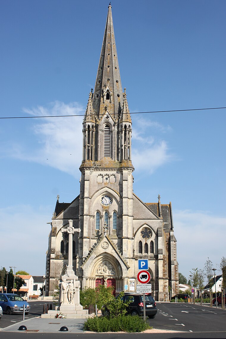
Photo: Llann Wé², CC BY-SA 4.0.
Église Saint-Philbert de Saint-Philbert-de-Grand-Lieu is a church.
Chapelle Lamoricière de Saint-Philbert-de-Grand-Lieu
Church

Photo: Llann Wé², CC BY-SA 4.0.
Chapelle Lamoricière de Saint-Philbert-de-Grand-Lieu is a church.
Places in the Area
Nearby places include Saint-Philbert-de-Grand-Lieu and La Chevrolière.
Saint-Philbert-de-Grand-Lieu
Village

Photo: Cyril5555, CC BY-SA 3.0.
Saint-Philbert-de-Grand-Lieu is a commune in the Loire-Atlantique department in western France. It is about 400 km southwest of Paris, via Chartres, Le Mans, Angers, and Nantes. The town is twinned with the Welsh suburb of Radyr in Cardiff, Wales's Capital.
La Chevrolière
Village

Photo: Cyril5555, CC BY-SA 3.0.
La Chevrolière is a commune in the Loire-Atlantique department in western France. La Chevrolière is situated 5 km north of La Guinèvre.
Saint-Aignan-Grandlieu
Village

Photo: Pymouss44, CC BY-SA 3.0.
Saint-Aignan-Grandlieu is a commune in the Loire-Atlantique department in the administrative region of Pays de la Loire, France. As of 2015, it had a population of… Saint-Aignan-Grandlieu is situated 8 km north of La Guinèvre.
La Guinèvre
- Type: Hamlet
- Category: locality
- Location: Saint-Philbert-de-Grand-Lieu, Arrondissement of Nantes, Loire-Atlantique, Pays de la Loire, France, Europe
- View on OpenStreetMap
Latitude
47.05127° or 47° 3′ 5″ northLongitude
-1.63687° or 1° 38′ 13″ westOpen location code
8CVW3927+G7OpenStreetMap ID
node 1701158601OpenStreetMap feature
place=hamlet
This page is based on OpenStreetMap, Wikidata, and Wikimedia Commons.
We’d love your help improving our open data sources. Thank you for contributing.
Satellite Map
Discover La Guinèvre from above in high-definition satellite imagery.
Localities in the Area
Explore places such as La Provôte and Le Moulin de la Chaussée.
Notable Places Nearby
Highlights include L’Orange Bleue and Centre Aquatique le Grand 9.
Pays de la Loire: Must-Visit Destinations
Delve into Montsoreau, Nantes, Angers, and Le Mans.
Curious Hamlets to Discover
Uncover intriguing hamlets from every corner of the globe.
About Mapcarta. Data © OpenStreetMap contributors and available under the Open Database License". Text is available under the CC BY-SA 4.0 license, except for photos, directions, and the map. Photo: DakoR, CC BY-SA 3.0.