Unanue
Unanue is a bus stop in Chorrillos District, Lima. Unanue is situated nearby to the pitch Complejo Deportivo ‘Túpac Gool’, as well as near the marketplace Mercado Santa Rosa.| Tap on a place to explore it |
Places of Interest Nearby
Highlights include Officers’ School of the National Police of Peru and Las Palmas Air Base.
Officers’ School of the National Police of Peru
College
The Officers' School of the National Police of Peru is a police academy in charge of training law enforcement recruits in Peru. It is based in the Chorrillos District of Lima, and is considered the alma mater of the police officers of the country. Officers’ School of the National Police of Peru is situated 2 km northwest of Unanue.
Las Palmas Air Base
Aerodrome
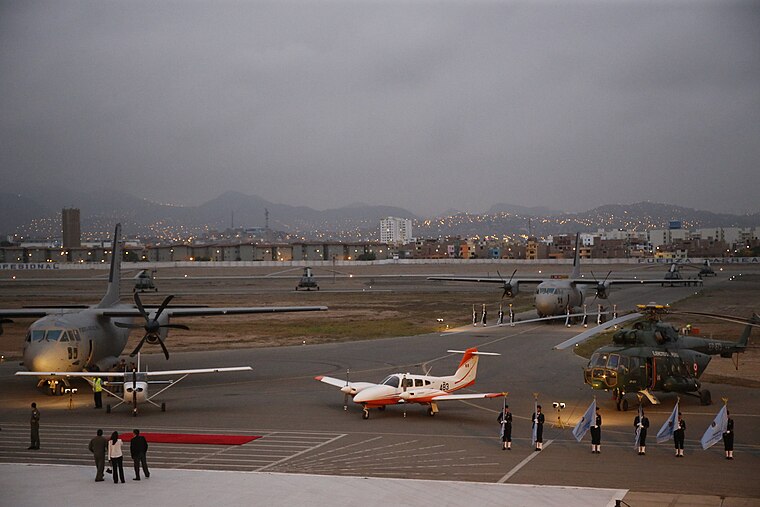 Las Palmas Air Base is a military airport in Santiago de Surco District, city of Lima, Peru. It is administered by the Peruvian Air Force, one of three branches of the Peruvian Armed Forces. Las Palmas Air Base is situated 4 km northwest of Unanue.
Terminal Matellini
Bus station
 Metropolitano is a bus rapid transit system serving the city of Lima, Peru. Its construction began in the year 2006. Terminal Matellini is situated 3 km northwest of Unanue.
Places in the Area
Nearby places include La Encantada de Villa and Barranco.
La Encantada de Villa
Neighborhood

Photo: AlejandroFC, CC BY-SA 4.0.
La Encantada de Villa is a neighborhood, which is situated 3½ km southwest of Unanue.
Barranco
 Barranco is a suburb or barrio of Lima the capital city of Peru. Barranco is south of Miraflores with many clubs and cafes popular among college students in Lima.
Unanue
- Type: Bus stop
- Category: transportation
- Location: Chorrillos District, Lima, Lima region, Peru, South America
- View on OpenStreetMap
Latitude
-12.1921° or 12° 11′ 32″ southLongitude
-76.98314° or 76° 58′ 59″ westOpen location code
57V5R258+5POpenStreetMap ID
node 1701428480OpenStreetMap feature
highway=bus_stop
This page is based on OpenStreetMap, Wikidata, and Wikimedia Commons.
We’d love your help improving our open data sources. Thank you for contributing.
Satellite Map
Discover Unanue from above in high-definition satellite imagery.
Places with the Same Name
Discover other places named “Unanue”.
Notable Places Nearby
Highlights include Complejo Deportivo ‘Túpac Gool’ and Mercado Santa Rosa.
Nearby Places
Explore places such as Restaurant Cevichería Misky and Scanner.
Peru: Must-Visit Destinations
Delve into Lima, Machu Picchu, Cuzco, and Arequipa.
Curious Bus Stops to Discover
Uncover intriguing bus stops from every corner of the globe.
About Mapcarta. Data © OpenStreetMap contributors and available under the Open Database License". Text is available under the CC BY-SA 4.0 license, except for photos, directions, and the map. Photo: Wikimedia, CC BY 3.0.