AE153- Mas Ventós
AE153- Mas Ventós is in Girona, Catalonia. AE153- Mas Ventós is situated nearby to the scenic viewpoint Mirador de Mas ventós, as well as near the archaeological site Dolmen del Coll del Bosc de la Margalla.| Tap on a place to explore it |
Places of Interest Nearby
Highlights include Paradolmen de la Pallera and Santa Helena de Rodes.
Paradolmen de la Pallera
Archaeological site
 Paradolmen de la Pallera is an archaeological site, which is situated 1 km northeast of AE153- Mas Ventós.
Santa Helena de Rodes
Church

Photo: Baldiri, CC BY-SA 3.0.
Santa Helena de Rodes is a church, which is situated 1 km east of AE153- Mas Ventós.
Dolmen de les Vinyes Mortes I
Archaeological site

Photo: Jean-Pierre Dalbéra, CC BY 2.0.
Dolmen de les Vinyes Mortes I is an archaeological site, which is situated 1¼ km northwest of AE153- Mas Ventós.
Places in the Area
Nearby places include Palau-saverdera and Pau.
Palau-saverdera
Village
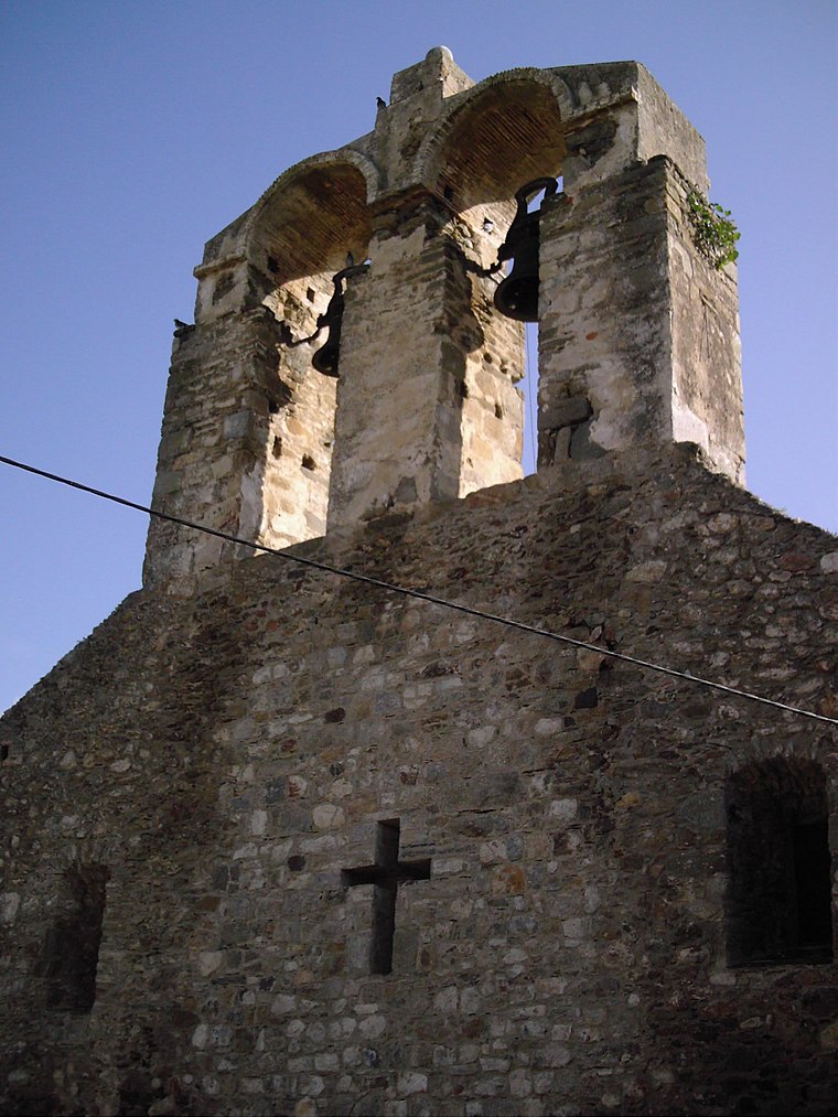
Photo: Wikimedia, CC BY-SA 3.0.
Palau-saverdera (Old Catalan for 'Palace- the Verdera'; is a municipality in the comarca of Alt Empordà, Girona, Catalonia, Spain.
Pau
Village

Photo: Wikimedia, CC BY-SA 3.0.
Pau is a municipality in the comarca of Alt Empordà, Girona, Catalonia, Spain. Pau is situated 3 km west of AE153- Mas Ventós.
La Selva de Mar
Village

Photo: Viatgepercatalunya, CC BY-SA 3.0.
La Selva de Mar is a municipality in the comarca of Alt Empordà in Catalonia, Spain. It is quite small with a population of about 197. The nearest town is El Port de la Selva, a common destination for beach-going tourists. La Selva de Mar is situated 3 km east of AE153- Mas Ventós.
AE153- Mas Ventós
- Type: Sign
- Categories: information and tourism
- Location: Girona, Catalonia, Eastern Spain, Spain, Iberia, Europe
- View on OpenStreetMap
Latitude
42.3252° or 42° 19′ 31″ northLongitude
3.14863° or 3° 8′ 55″ eastOperator
ItinerànniaOpen location code
8FJ584GX+3FOpenStreetMap ID
node 1736409517OpenStreetMap feature
tourism=information
This page is based on OpenStreetMap, Wikidata, and Wikimedia Commons.
We’d love your help improving our open data sources. Thank you for contributing.
Satellite Map
Discover AE153- Mas Ventós from above in high-definition satellite imagery.
Notable Places Nearby
Highlights include Mas Ventós and Mirador de Mas ventós.
Nearby Places
Explore places such as AE154- Cista del Coll del bosc de la Margalla and Una vila pròspera.
Girona: Must-Visit Destinations
Delve into Girona, Figueres, Llivia, and Lloret de Mar.
Curious Places to Discover
Uncover intriguing places from every corner of the globe.
About Mapcarta. Data © OpenStreetMap contributors and available under the Open Database License". Text is available under the CC BY-SA 4.0 license, except for photos, directions, and the map. Photo: Wikimedia, CC0.