Predoslje Š
Predoslje Š is a bus stop in Kranj, Central Slovenia. Predoslje Š is situated nearby to the athletics track Sprint steza, as well as near the hamlet Orehovlje.| Tap on a place to explore it |
Places of Interest Nearby
Highlights include Castle Khislstein and Prešeren Grove.
Castle Khislstein
Castle
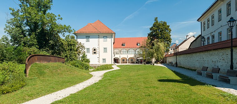
Photo: Meho29, CC BY-SA 4.0.
Kieselstein Castle, also known as Khislstein, is a 13th-century castle in the city of Kranj, in the Upper Carniola region of Slovenia. The castle stands at what was once a defensible point, guarding the city pier and crossing over the river Sava, and was predated on the site by a round 11th-century keep. Castle Khislstein is situated 4 km southwest of Predoslje Š.
Prešeren Grove
Park

Photo: Meho29, CC BY-SA 3.0.
Prešeren Grove is a park, which is situated 3 km southwest of Predoslje Š.
Slovene Square
Square

Photo: Meho29, CC BY-SA 3.0.
Slovene Square is situated 3½ km southwest of Predoslje Š.
Places in the Area
Nearby places include Predoslje and Orehovlje.
Predoslje
Village

Photo: Doremo, CC BY-SA 3.0.
Predoslje is a village in the Municipality of Kranj in the Upper Carniola region of Slovenia. The territory of the village includes Brdo Castle.
Orehovlje
Hamlet

Photo: Doremo, CC BY-SA 3.0.
Orehovlje is a settlement on the right bank of the Kokra River in the Municipality of Kranj in the Upper Carniola region of Slovenia.
Britof
Village

Photo: Doremo, CC BY-SA 3.0.
Britof is a settlement just northeast of the town of Kranj in the Upper Carniola region of Slovenia.
Predoslje Š
- Type: Bus stop
- Category: transportation
- Location: Kranj, Central Slovenia, Slovenia, Central Europe, Europe
- View on OpenStreetMap
Latitude
46.26574° or 46° 15′ 57″ northLongitude
14.38724° or 14° 23′ 14″ eastOpen location code
8FRP798P+7VOpenStreetMap ID
node 1744777037OpenStreetMap feature
highway=bus_stopOpenStreetMap feature
public_transport=platform
This page is based on OpenStreetMap, Wikidata, and Wikimedia Commons.
We’d love your help improving our open data sources. Thank you for contributing.
Satellite Map
Discover Predoslje Š from above in high-definition satellite imagery.
Notable Places Nearby
Highlights include Sprint steza and PGD Predoslje.
Nearby Places
Explore places such as Predoslje Š and Osnovna šola Predoslje.
Central Slovenia: Must-Visit Destinations
Delve into Ljubljana, Škofja Loka, Kamnik, and Grosuplje.
Curious Bus Stops to Discover
Uncover intriguing bus stops from every corner of the globe.
About Mapcarta. Data © OpenStreetMap contributors and available under the Open Database License". Text is available under the CC BY-SA 4.0 license, except for photos, directions, and the map. Photo: Meho29, CC BY-SA 3.0.