König-Konrad-Denkmal
König-Konrad-Denkmal is a scenic viewpoint in Villmar, Limburg-Weilburg, Hesse. König-Konrad-Denkmal is situated nearby to the nature reserve Bodensteinerlai, as well as near the quarry Bongard Bruch.| Tap on a place to explore it |
Places of Interest Nearby
Highlights include Lahn-Marmor-Museum and Wehrley von Runkel.
Lahn-Marmor-Museum
Museum
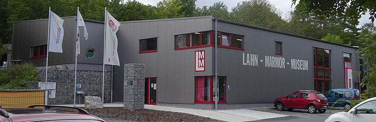
Photo: Christof Ellger, CC BY-SA 4.0.
Lahn-Marmor-Museum is situated 800 metres northeast of König-Konrad-Denkmal.

Unica-Bruch
Quarry

Photo: Dysmachus, CC BY-SA 3.0.
Unica-Bruch is a quarry, which is situated 570 metres northeast of König-Konrad-Denkmal.
Places in the Area
Nearby places include Dauborn and Limburg an der Lahn.
Dauborn
Village

Photo: Hintertaunus, Public domain.
Dauborn is a village, which is situated 7 km south of König-Konrad-Denkmal.
Limburg an der Lahn

Photo: Mr.Nutt, CC BY-SA 4.0.
Limburg an der Lahn is in Hesse. The town is famous for its marvellous mediaeval town centre with its timber-framed houses and its Dom.
König-Konrad-Denkmal
- Type: Scenic viewpoint
- Categories: tourism, historic site, and memorial
- Location: Villmar, Limburg-Weilburg, Giessen, Hesse, Germany, Central Europe, Europe
- View on OpenStreetMap
Latitude
50.39192° or 50° 23′ 31″ northLongitude
8.17723° or 8° 10′ 38″ eastOpen location code
9F2C95RG+QVOpenStreetMap ID
node 1769753749OpenStreetMap feature
historic=memorialOpenStreetMap feature
tourism=viewpoint
This page is based on OpenStreetMap, Wikidata, and Wikimedia Commons.
We’d love your help improving our open data sources. Thank you for contributing.
Satellite Map
Discover König-Konrad-Denkmal from above in high-definition satellite imagery.
Notable Places Nearby
Highlights include Bodensteinerlai and Blick auf König Konrad Denkmal.
Nearby Places
Explore places such as Naturpark and König-Konrad Denkmal.
Hesse: Must-Visit Destinations
Delve into Frankfurt, Wiesbaden, Darmstadt, and Kassel.
Curious Scenic Viewpoints to Discover
Uncover intriguing scenic viewpoints from every corner of the globe.
About Mapcarta. Data © OpenStreetMap contributors and available under the Open Database License". Text is available under the CC BY-SA 4.0 license, except for photos, directions, and the map. Photo: Pedelecs, CC BY-SA 3.0.