Chemmiflue
Chemmiflue is in Thierstein District, Canton of Solothurn. Chemmiflue is situated nearby to the peak Chemiflue, as well as near the pitch Modellflugverein Breitenbach.| Tap on a place to explore it |
Places of Interest Nearby
Highlights include Neu-Thierstein Castle and St. Peter and Paul parish church.
Neu-Thierstein Castle
Castle
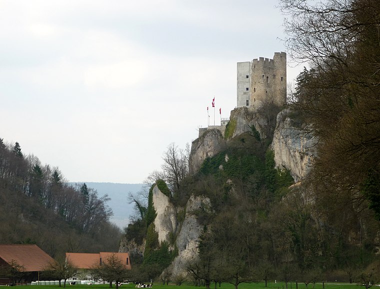
Photo: Gestumblindi, CC0.
Neu-Thierstein Castle is a ruined castle in the Swiss municipality of Büsserach in the canton of Solothurn, Switzerland. Neu-Thierstein Castle is situated 750 metres west of Chemmiflue.
St. Peter and Paul parish church
Church

Photo: Wikimedia, CC BY-SA 3.0.
St. Peter and Paul parish church is situated 1¼ km southwest of Chemmiflue.
Ruine Bännlifels
Archaeological site

Photo: Kvgunten, CC BY-SA 4.0.
Ruine Bännlifels is an archaeological site, which is situated 2½ km west of Chemmiflue.
Places in the Area
Nearby places include Büsserach and Erschwil.
Büsserach
Village

Photo: DidiWeidmann, CC BY-SA 3.0.
Büsserach is a municipality in the district of Thierstein in the canton of Solothurn in Switzerland.
Erschwil
Village

Photo: Minnou, CC BY-SA 3.0.
Erschwil is a municipality in the district of Thierstein in the canton of Solothurn in Switzerland.
Breitenbach
Village

Photo: DidiWeidmann, CC BY-SA 3.0.
Breitenbach is a municipality in the district of Thierstein in the canton of Solothurn in Switzerland. There are two train stations near Breitenbach, the main being in Laufen and the other in Zwingen. Breitenbach is situated 2½ km north of Chemmiflue.
Chemmiflue
- Type: Sign
- Categories: information and tourism
- Location: Thierstein District, Canton of Solothurn, Switzerland, Central Europe, Europe
- View on OpenStreetMap
Latitude
47.38443° or 47° 23′ 4″ northLongitude
7.54826° or 7° 32′ 54″ eastElevation
701 metres (2,300 feet)Open location code
8FV99GMX+Q8OpenStreetMap ID
node 1782381851OpenStreetMap feature
tourism=information
This page is based on OpenStreetMap, Wikidata, and Wikimedia Commons.
We’d love your help improving our open data sources. Thank you for contributing.
Satellite Map
Discover Chemmiflue from above in high-definition satellite imagery.
Notable Places Nearby
Highlights include Chemiflue and Modellflugverein Breitenbach.
Nearby Places
Explore places such as Büsserach, Ziegelhütte and Ziegelhütte.
Switzerland: Must-Visit Destinations
Delve into Zurich, Berne, Geneva, and Basel.
Curious Places to Discover
Uncover intriguing places from every corner of the globe.
About Mapcarta. Data © OpenStreetMap contributors and available under the Open Database License". Text is available under the CC BY-SA 4.0 license, except for photos, directions, and the map. Photo: Simonizer, CC BY-SA 2.0 de.