Germaniadenkmal in Ruhland
Germaniadenkmal in Ruhland is a memorial in Ruhland, Oberspreewald-Lausitz, Brandenburg. Germaniadenkmal in Ruhland is situated nearby to Ruhland parish church, as well as near the historic site Polish-Saxony postmilestone of Ruhland.| Tap on a place to explore it |
Places of Interest Nearby
Highlights include Ruhland parish church and Polish-Saxony postmilestone of Ruhland.

Polish-Saxony postmilestone of Ruhland
Historic site
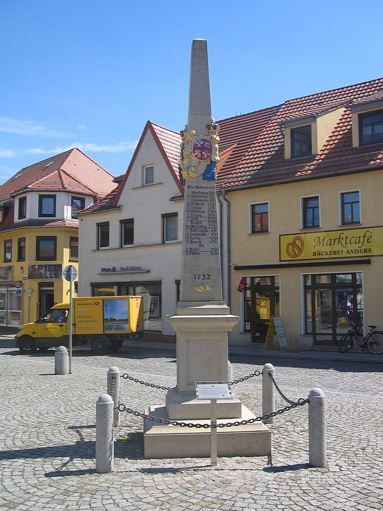
Photo: Wilhelm Zimmerling PAR, CC BY-SA 4.0.
Polish-Saxony postmilestone of Ruhland is a historic site.
Gutshof in Ruhland
Manor estate
 Gutshof in Ruhland is a manor estate, which is situated 270 metres west of Germaniadenkmal in Ruhland.
Places in the Area
Nearby places include Ruhland and Schwarzheide.
Ruhland
Town
 Ruhland is a town in the Oberspreewald-Lausitz district, in Upper Lusatia, Brandenburg, in eastern Germany. It is situated on the river Schwarze Elster, 12 kilometres southwest of Senftenberg. Ruhland station is a major railway junction, for freight and for passenger services.
Schwarzheide
Town

Photo: Oberlausitzerin64, CC BY-SA 4.0.
Schwarzheide is a town in the Oberspreewald-Lausitz district, in Lower Lusatia, Brandenburg, Germany. It is situated on the river Schwarze Elster, 11 km southwest of Senftenberg, 110 km south of Berlin and 40 km north of Dresden. Schwarzheide is situated 4 km northwest of Germaniadenkmal in Ruhland.
Schwarzbach
Village

Photo: DorisAntony, CC BY-SA 4.0.
Schwarzbach is a municipality in the Oberspreewald-Lausitz district, in Upper Lusatia, Brandenburg, Germany. Schwarzbach is situated 5 km east of Germaniadenkmal in Ruhland.
Germaniadenkmal in Ruhland
- Type: Memorial
- Categories: war memorial and historic site
- Location: Ruhland, Oberspreewald-Lausitz, Brandenburg, Germany, Central Europe, Europe
- View on OpenStreetMap
Latitude
51.45852° or 51° 27′ 31″ northLongitude
13.86704° or 13° 52′ 1″ eastOpen location code
9F3MFV58+CROpenStreetMap ID
node 1836218741OpenStreetMap feature
historic=memorialWikidata ID
Q48753540
This page is based on OpenStreetMap, Wikidata, and Wikimedia Commons.
We’d love your help improving our open data sources. Thank you for contributing.
Satellite Map
Discover Germaniadenkmal in Ruhland from above in high-definition satellite imagery.
In Other Languages
“Germaniadenkmal in Ruhland” goes by many names.
- German: “Germania-Denkmal”
- German: “Germaniadenkmal in Ruhland”
Notable Places Nearby
Highlights include Geschwister-Scholl-Schule Ruhland and Polizeiposten.
Nearby Places
Explore places such as Lotto Jank and Reisebüro Richter.
Brandenburg: Must-Visit Destinations
Delve into Potsdam, Cottbus, Frankfurt an der Oder, and Brandenburg an der Havel.
Curious Memorials to Discover
Uncover intriguing memorials from every corner of the globe.
About Mapcarta. Data © OpenStreetMap contributors and available under the Open Database License". Text is available under the CC BY-SA 4.0 license, except for photos, directions, and the map. Photo: Z thomas, CC BY 3.0.