Getränke Hafele
Getränke Hafele is a beverage shop in Ried im Oberinntal, Landeck, Tyrol. Getränke Hafele is situated nearby to the miniature golf course Migetgolf, as well as near the church St. Maria Lourdes-Grotte.| Tap on a place to explore it |
Places of Interest Nearby
Highlights include Schloss Sigmundsried, Ried im Oberinntal and Schulerkapelle.
Schloss Sigmundsried, Ried im Oberinntal
Castle

Photo: Gpatsche, CC BY-SA 3.0 at.
Schloss Sigmundsried, Ried im Oberinntal is a castle, which is situated 600 metres east of Getränke Hafele.
Schulerkapelle
Church
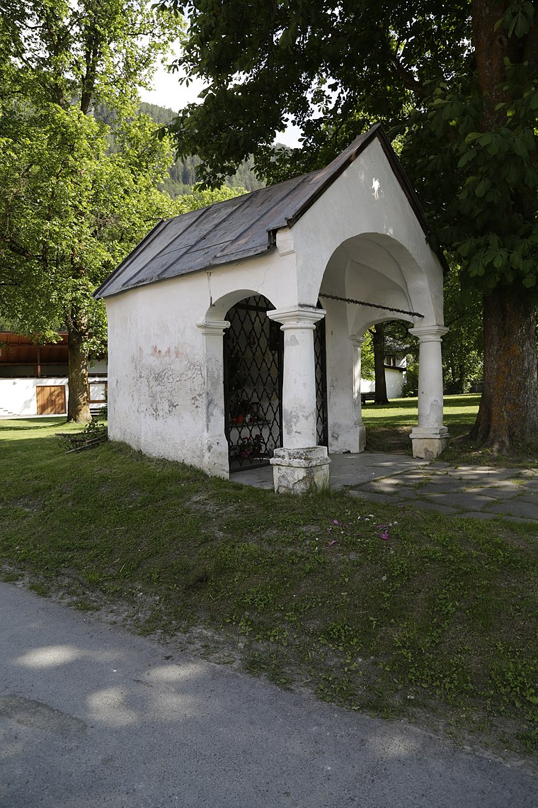
Photo: Bobo11, CC BY-SA 4.0.
Schulerkapelle is a church, which is situated 620 metres east of Getränke Hafele.
Pfarrkirche hl. Leonhard, Ried im Oberinntal
Church

Photo: Gpatsche, CC BY-SA 3.0 at.
Pfarrkirche hl. Leonhard, Ried im Oberinntal is a church, which is situated 800 metres northeast of Getränke Hafele.
Places in the Area
Nearby places include Ladis and Fendels.
Ladis
Village

Photo: Braveheart, CC BY-SA 4.0.
Ladis is a municipality in the district of Landeck in the Austrian state of Tyrol located 9.5 km south of Landeck and 1.4 km west of Faggen. The village is known because of its sulphur and sour springs. Another important source of income is ski tourism.
Fendels
Village

Photo: Einer flog zu Weit, CC BY-SA 3.0.
Fendels is a municipality in the Landeck district in the Austrian state of Tyrol located 13 km south of Landeck on the upper course of the Inn River. The village was mentioned for the first time in documents in 1297. Fendels is situated 2½ km east of Getränke Hafele.
Kaunertal

Photo: Clemenspicture, CC BY 3.0.
The Kaunertal is a municipality and alpine valley in the Landeck district in the Austrian state of Tyrol. The municipality is located about 15 km southeast of Landeck at the upper course of the Inn river.
Getränke Hafele
- Type: Beverage shop
- Address: 276, Ried i.O., Ried im Oberinntal, 6531
- Category: shop
- Location: Ried im Oberinntal, Landeck, Tyrol, Austria, Central Europe, Europe
- View on OpenStreetMap
Latitude
47.05179° or 47° 3′ 6″ northLongitude
10.64409° or 10° 38′ 39″ eastOpen location code
8FVG3J2V+PJOpenStreetMap ID
node 1837676942OpenStreetMap feature
shop=beverages
This page is based on OpenStreetMap, Wikidata, and Wikimedia Commons.
We’d love your help improving our open data sources. Thank you for contributing.
Satellite Map
Discover Getränke Hafele from above in high-definition satellite imagery.
Notable Places Nearby
Highlights include Migetgolf and St. Maria Lourdes-Grotte.
Nearby Places
Explore places such as Gewerbegebiet Ried-Altgreit and Station 276.
Tyrol: Must-Visit Destinations
Delve into Innsbruck, Kufstein, Lienz, and Kitzbühel.
Curious Beverage Shops to Discover
Uncover intriguing beverage shops from every corner of the globe.
About Mapcarta. Data © OpenStreetMap contributors and available under the Open Database License". Text is available under the CC BY-SA 4.0 license, except for photos, directions, and the map. Photo: Traveler100, CC BY-SA 3.0.