Caeser’s Foodlounge
Caeser’s Foodlounge is a fast food restaurant in Paderborn, Detmold, North Rhine-Westphalia which is located on Kilianstraße. Caeser’s Foodlounge is situated nearby to the post office Hermes Paketshop, as well as near the art gallery Picture’s Point.| Tap on a place to explore it |
- Opening hours: Wednesday—Monday and public holidays 11:00 AM—10:00 PM
- Type: Fast food restaurant
- Cuisine: kebab, burger, and pizza
- Also known as: “Onur Grill”
- Address: Kilianstraße 6, Paderborn, 33098
- Wheelchair access: limited
Places of Interest Nearby
Highlights include Marktkirche and Historisches Rathaus Paderborn.
Marktkirche
Church

Photo: Tsungam, CC BY-SA 4.0.
Marktkirche is a church, which is situated 250 metres northeast of Caeser’s Foodlounge.
Historisches Rathaus Paderborn
Town hall
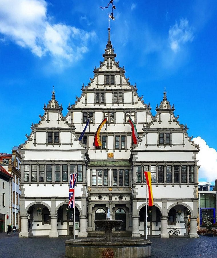
Photo: Sunnysteffen, CC BY-SA 4.0.
Historisches Rathaus Paderborn is a town hall, which is situated 380 metres north of Caeser’s Foodlounge.
Gymnasium Theodorianum
School
 The Gymnasium Theodorianum is a grammar school situated in the historic centre of Paderborn, Germany. Succeeding in the tradition of the cathedral school founded in 799, it is among the ten oldest schools in the world. Gymnasium Theodorianum is situated 300 metres northeast of Caeser’s Foodlounge.
Places in the Area
Nearby places include Benhausen and Borchen.
Benhausen
Village

Photo: Philipp Sx86, CC BY-SA 3.0.
Benhausen is a village, which is situated 6 km northeast of Caeser’s Foodlounge.
Borchen
Village

Photo: Unixbook, CC BY-SA 3.0.
Borchen is a municipality in the district of Paderborn, in North Rhine-Westphalia, Germany. Borchen is situated 6 km south of Caeser’s Foodlounge.
Sennelager
Village
Sennelager is a village in Germany that forms part of the City of Paderborn. It is notable for its association with the military since the 19th century. Sennelager is situated 7 km north of Caeser’s Foodlounge.
Caeser’s Foodlounge
- Categories: food and restaurant
- Location: Paderborn, Paderborn, Detmold, Teutoburg Forest, North Rhine-Westphalia, Germany, Central Europe, Europe
- View on OpenStreetMap
Latitude
51.71411° or 51° 42′ 51″ northLongitude
8.75206° or 8° 45′ 7″ eastOpen location code
9F3CPQ72+JROpenStreetMap ID
node 1845175375OpenStreetMap feature
amenity=fast_foodOpenStreetMap attribute
cuisine=kebabOpenStreetMap attribute
cuisine=burgerOpenStreetMap attribute
cuisine=pizzaOpenStreetMap attribute
wheelchair=limited
This page is based on OpenStreetMap, Wikidata, and Wikimedia Commons.
We’d love your help improving our open data sources. Thank you for contributing.
Satellite Map
Discover Caeser’s Foodlounge from above in high-definition satellite imagery.
Notable Places Nearby
Highlights include Hermes Paketshop and Picture’s Point.
Nearby Places
Explore places such as Punjabi Curryhaus and Lotto Voigt.
Teutoburg Forest: Must-Visit Destinations
Delve into Bielefeld, Detmold, Gütersloh, and Minden.
Curious Fast Food Restaurants to Discover
Uncover intriguing fast food restaurants from every corner of the globe.
About Mapcarta. Data © OpenStreetMap contributors and available under the Open Database License". Text is available under the CC BY-SA 4.0 license, except for photos, directions, and the map. Photo: Wikimedia, CC0.