Parkplatz A Freizeitsee Dießfurth
Parkplatz A Freizeitsee Dießfurth is a parking area in Grafenwöhr, Neustadt an der Waldnaab, Bavaria. Parkplatz A Freizeitsee Dießfurth is situated nearby to the lake Gmünder-Weiher, as well as near Opel-Weiher.| Tap on a place to explore it |
Places of Interest Nearby
Highlights include Grafenwöhr Army Airfield and St. Laurentius.
Grafenwöhr Army Airfield
Aerodrome
Grafenwöhr Army Airfield is a military airport near Grafenwöhr, a small town in Bavaria, Germany. It is located adjacent to the Grafenwöhr Training Area, for which it acts as an air assault zone.
St. Laurentius
Church

Photo: DALIBRI, CC BY-SA 4.0.
St. Laurentius is a church, which is situated 3 km south of Parkplatz A Freizeitsee Dießfurth.
Places in the Area
Nearby places include Pressath and Mantel.
Pressath
Town
 Pressath is a town in the district of Neustadt an der Waldnaab, in Bavaria, Germany. Pressath was founded in 1657. It is situated 20 km northwest of Weiden in der Oberpfalz and ca. 7 km north of Grafenwöhr. Pressath is situated 7 km north of Parkplatz A Freizeitsee Dießfurth.
Mantel
Village

Photo: Wikimedia, CC BY-SA 3.0.
Mantel is a municipality located in the district of Neustadt an der Waldnaab in Bavaria, Germany. It is known as a Markt, a town that was historically granted 'market rights'. Mantel is situated 8 km southeast of Parkplatz A Freizeitsee Dießfurth.
Weihersberg
Village
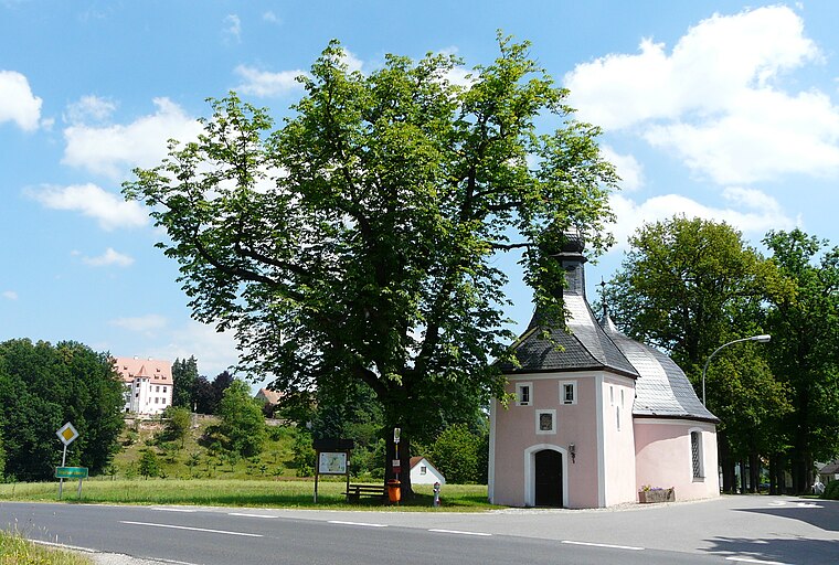
Photo: ME.Z, CC BY-SA 3.0.
Weihersberg is a village, which is situated 9 km north of Parkplatz A Freizeitsee Dießfurth.
Parkplatz A Freizeitsee Dießfurth
- Type: Parking area
- Parking: surface
- Category: transportation
- Location: Grafenwöhr, Neustadt an der Waldnaab, Upper Palatinate, Bavaria, Germany, Central Europe, Europe
- View on OpenStreetMap
Latitude
49.70787° or 49° 42′ 28″ northLongitude
11.97046° or 11° 58′ 14″ eastOpen location code
8FXHPX5C+45OpenStreetMap ID
node 1874693545OpenStreetMap feature
amenity=parkingOpenStreetMap attribute
parking=surface
This page is based on OpenStreetMap, Wikidata, and Wikimedia Commons.
We’d love your help improving our open data sources. Thank you for contributing.
Satellite Map
Discover Parkplatz A Freizeitsee Dießfurth from above in high-definition satellite imagery.
Notable Places Nearby
Highlights include Freizeitsee Dießfurt and Gmünder-Weiher.
Nearby Places
Explore places such as Josephsthal and Gaststätte Josephstal.
Upper Palatinate: Must-Visit Destinations
Delve into Regensburg, Amberg, Cham, and Schwandorf.
Curious Parking Areas to Discover
Uncover intriguing parking areas from every corner of the globe.
About Mapcarta. Data © OpenStreetMap contributors and available under the Open Database License". Text is available under the CC BY-SA 4.0 license, except for photos, directions, and the map. Photo: Wikimedia, CC0.