Freiwillige Feuerwehr Bad Urach
Freiwillige Feuerwehr Bad Urach is a fire station in Bad Urach, Reutlingen, Baden-Württemberg which is located on Espachstraße. Freiwillige Feuerwehr Bad Urach is situated nearby to the fire station Freiwillige Feuerwehr Gerätehaus, as well as near the police station Polizeiposten Bad Urach.| Tap on a place to explore it |
Places of Interest Nearby
Highlights include Schloss Urach and City hall Bad Urach.
Schloss Urach
Castle

Photo: Misburg3014, CC BY-SA 3.0.
Schloss Urach is a castle, which is situated 390 metres west of Freiwillige Feuerwehr Bad Urach.
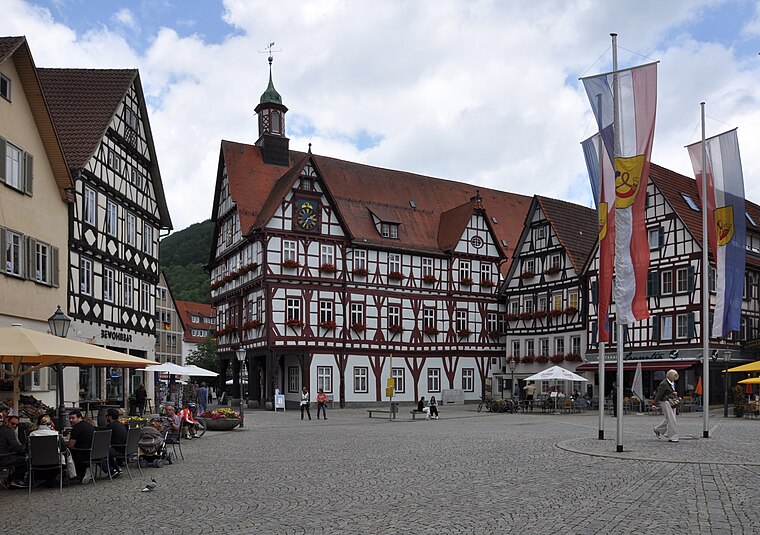
City hall Bad Urach
Town hall

Photo: W. Bulach, CC BY-SA 4.0.
City hall Bad Urach is a town hall, which is situated 320 metres northwest of Freiwillige Feuerwehr Bad Urach.
Marktplatz Bad Urach
Square
 Marktplatz Bad Urach is a square, which is situated 260 metres northwest of Freiwillige Feuerwehr Bad Urach.
Places in the Area
Nearby places include Hülben and Dettingen an der Erms.
Hülben
Village

Photo: Aspiriniks, CC BY-SA 3.0.
Hülben is a village, which is situated 3 km north of Freiwillige Feuerwehr Bad Urach.
Dettingen an der Erms
Village

Photo: DerFussi, CC BY-SA 3.0.
Dettingen an der Erms is a town in the district of Reutlingen in Baden-Württemberg in Germany. The town about twelve kilometers north-east of Reutlingen in Baden-Wuerttemberg or about 46 kilometers from Stuttgart. Dettingen an der Erms is situated 6 km northwest of Freiwillige Feuerwehr Bad Urach.
Seeburg
Village

Photo: Xocolatl, Public domain.
Seeburg is a village, which is situated 6 km southeast of Freiwillige Feuerwehr Bad Urach.
Freiwillige Feuerwehr Bad Urach
- Type: Fire station
- Address: Espachstraße 1, Bad Urach, 72574
- Location: Bad Urach, Reutlingen, Tübingen Region, Baden-Württemberg, Germany, Central Europe, Europe
- View on OpenStreetMap
Latitude
48.49115° or 48° 29′ 28″ northLongitude
9.40199° or 9° 24′ 7″ eastOpen location code
8FWFFCR2+FQOpenStreetMap ID
node 1885303354OpenStreetMap feature
amenity=fire_station
This page is based on OpenStreetMap, Wikidata, and Wikimedia Commons.
We’d love your help improving our open data sources. Thank you for contributing.
Satellite Map
Discover Freiwillige Feuerwehr Bad Urach from above in high-definition satellite imagery.
Notable Places Nearby
Highlights include Freiwillige Feuerwehr Gerätehaus and Polizeiposten Bad Urach.
Nearby Places
Explore places such as Autohaus Simon Rath and DRK-Ortsverein Bad Urach.
Baden-Württemberg: Must-Visit Destinations
Delve into Stuttgart, Heidelberg, Karlsruhe, and Mannheim.
Curious Fire Stations to Discover
Uncover intriguing fire stations from every corner of the globe.
About Mapcarta. Data © OpenStreetMap contributors and available under the Open Database License". Text is available under the CC BY-SA 4.0 license, except for photos, directions, and the map. Photo: Traveler100, CC BY-SA 3.0.