Colegio de Educación Infantil y Primaria Poeta Francisco Tarajano
Colegio de Educación Infantil y Primaria Poeta Francisco Tarajano is a school in Telde, Las Palmas. Colegio de Educación Infantil y Primaria Poeta Francisco Tarajano is situated nearby to the park Plaza de La Herradura, as well as near Plaza de San José de Las Longueras.| Tap on a place to explore it |
Places of Interest Nearby
Highlights include Ermita de San José de las Longueras and Casa-Museo León y Castillo.
Ermita de San José de las Longueras
Church

Photo: CitoplasmaX, CC BY-SA 4.0.
Ermita de San José de las Longueras is a church, which is situated 700 metres southwest of Colegio de Educación Infantil y Primaria Poeta Francisco Tarajano.
Casa-Museo León y Castillo
Museum
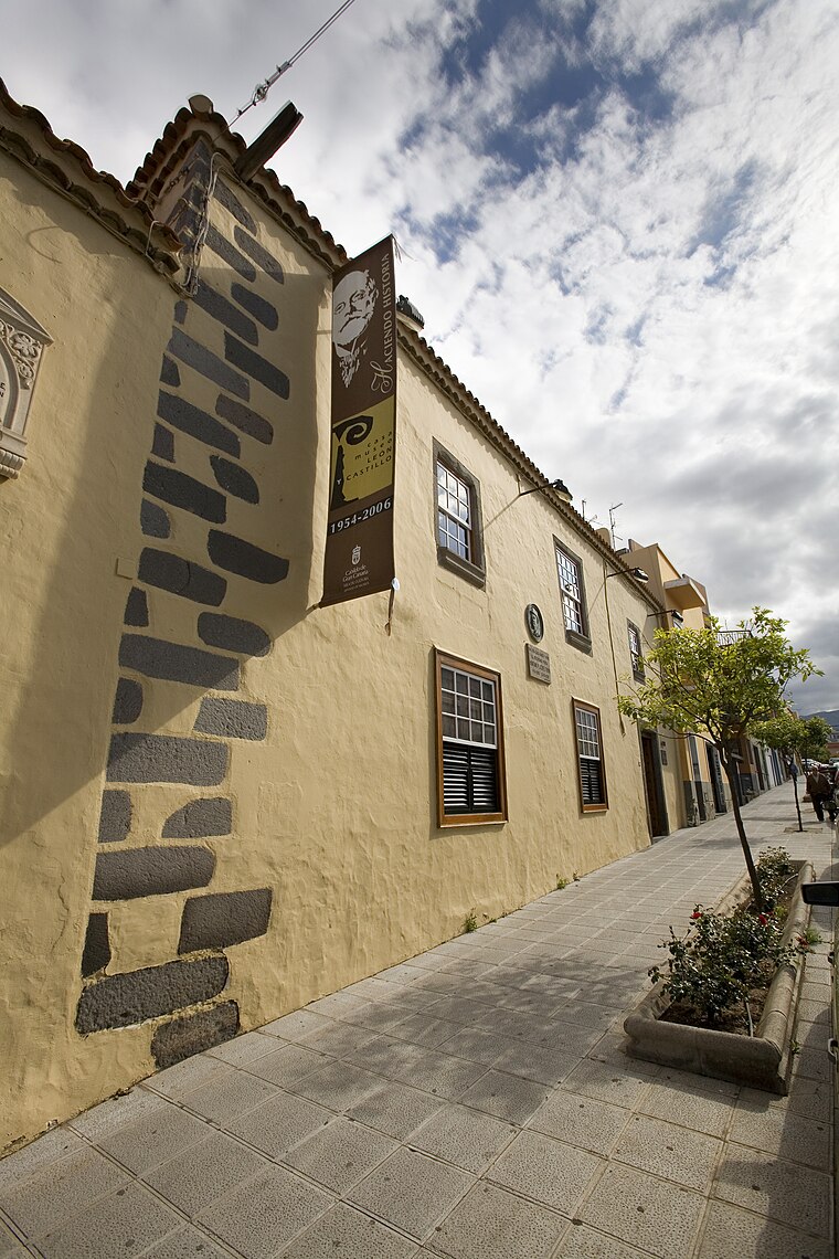
Photo: Raycojimenezg, CC BY-SA 3.0.
Casa-Museo León y Castillo is a museum, which is situated 1½ km east of Colegio de Educación Infantil y Primaria Poeta Francisco Tarajano.
Basilica of San Juan Bautista
Church

Photo: Wikimedia, Public domain.
Basilica of San Juan Bautista is a church, which is situated 2 km east of Colegio de Educación Infantil y Primaria Poeta Francisco Tarajano.
Places in the Area
Nearby places include Eastern Gran Canaria and Lomo Magullo.
Eastern Gran Canaria
The eastern part of Gran Canaria is the economically most important part of the island. Traces of the "old Canaries" can be found here, where the oldest settlements of the Spaniards were.Lomo Magullo
Suburb

Photo: DanielRiveroSuárez, CC BY-SA 3.0.
Lomo Magullo is a suburb, which is situated 3 km southwest of Colegio de Educación Infantil y Primaria Poeta Francisco Tarajano.
Tufia
Hamlet

Photo: André Hoek, CC BY-SA 3.0.
Tufia is a hamlet, which is situated 6 km southeast of Colegio de Educación Infantil y Primaria Poeta Francisco Tarajano.
Colegio de Educación Infantil y Primaria Poeta Francisco Tarajano
- Type: School
- Also known as: “CEIP Poeta Francisco Tarajano”
- Category: education
- Location: Telde, Las Palmas, Canary Islands, Spain, Iberia, Europe
- View on OpenStreetMap
Latitude
27.99713° or 27° 59′ 50″ northLongitude
-15.43127° or 15° 25′ 53″ westOpen location code
7CV6XHW9+RFOpenStreetMap ID
node 1889966381OpenStreetMap feature
amenity=school
This page is based on OpenStreetMap, Wikidata, and Wikimedia Commons.
We’d love your help improving our open data sources. Thank you for contributing.
Satellite Map
Discover Colegio de Educación Infantil y Primaria Poeta Francisco Tarajano from above in high-definition satellite imagery.
Notable Places Nearby
Highlights include Plaza de La Herradura and Plaza de San José de Las Longueras.
Nearby Places
Explore places such as Instituto de Educación Secundaria Lomo de La Herradura and Fulton Nº45.
Canary Islands: Must-Visit Destinations
Delve into Santa Cruz de Tenerife, Las Palmas, La Palma, and La Gomera.
Curious Schools to Discover
Uncover intriguing schools from every corner of the globe.
About Mapcarta. Data © OpenStreetMap contributors and available under the Open Database License". Text is available under the CC BY-SA 4.0 license, except for photos, directions, and the map. Photo: TK-lion, CC BY-SA 4.0.