Mitterzeile
Mitterzeile is a dwelling in Alpbach, Kufstein District, Tyrol. Mitterzeile is situated nearby to the church Rossmooskapelle, as well as near the museum Brechlstube.| Tap on a place to explore it |
Places of Interest Nearby
Highlights include Congress Centrum Alpbach and Schatzberg.
Congress Centrum Alpbach
Convention center

Photo: Karl Gruber, CC BY-SA 3.0.
Congress Centrum Alpbach is a convention center, which is situated 1¼ km northwest of Mitterzeile.
Schatzberg
Peak

Photo: Svíčková, CC BY-SA 3.0.
The Schatzberg is a 1,898-metre-high mountain in the Kitzbühel Alps in the Austrian state of Tyrol. It is also a winter sports area.
Saint Oswald of Northumbria Church
Church
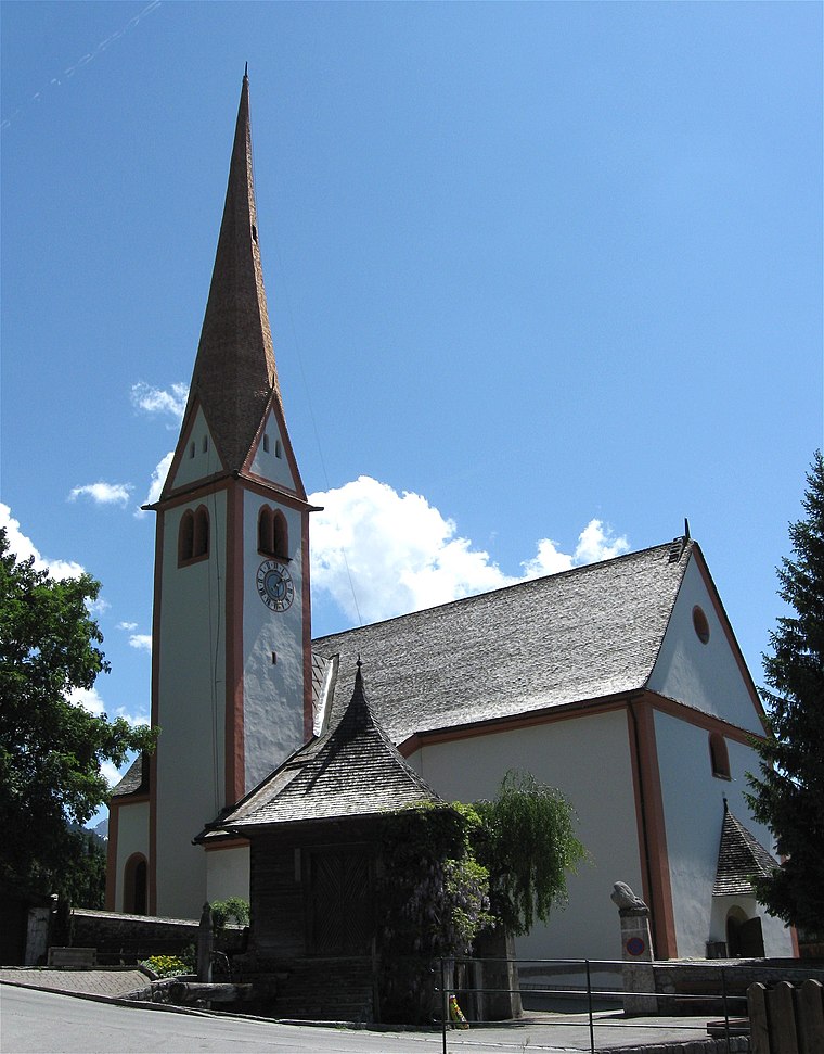
Photo: Rufus46, CC BY-SA 3.0.
Saint Oswald of Northumbria Church is situated 1¼ km northwest of Mitterzeile.
Places in the Area
Nearby places include Thierbach and Auffach.
Thierbach
Village

Photo: Vámos Sándor, CC BY-SA 3.0.
Thierbach is a village, which is situated 4½ km northeast of Mitterzeile.
Auffach
Village
Auffach is a village and Katastralgemeinde in Wildschönau municipality within Kufstein District in the state of Tyrol, Austria. Auffach is situated 6 km northeast of Mitterzeile.
Schloss Matzen
Locality

Photo: Wolkenkratzer, CC BY-SA 4.0.
Schloss Matzen is a historic Austrian castle, located in the Tyrol near the branch of the Ziller Valley from the main Inn valley. Strategically located to control one of the major transalpine trade routes, the origins of the castle date from Roman times and it has a distinctive round tower thought to be of possible Roman derivation. Schloss Matzen is situated 8 km northwest of Mitterzeile.
Mitterzeile
- Type: Dwelling
- Categories: locality, residential building, and building
- Location: Alpbach, Kufstein District, Tyrol, Austria, Central Europe, Europe
- View on OpenStreetMap
Latitude
47.38942° or 47° 23′ 22″ northLongitude
11.95583° or 11° 57′ 21″ eastOpen location code
8FVH9XQ4+Q8OpenStreetMap ID
node 1912466088OpenStreetMap feature
place=isolated_dwelling
This page is based on OpenStreetMap, Wikidata, and Wikimedia Commons.
We’d love your help improving our open data sources. Thank you for contributing.
Satellite Map
Discover Mitterzeile from above in high-definition satellite imagery.
Notable Places Nearby
Highlights include Rossmooskapelle and Brechlstube.
Nearby Places
Explore places such as Apartmenthaus Rosenhof and Almladen.
Tyrol: Must-Visit Destinations
Delve into Innsbruck, Kufstein, Lienz, and Kitzbühel.
Curious Dwellings to Discover
Uncover intriguing dwellings from every corner of the globe.
About Mapcarta. Data © OpenStreetMap contributors and available under the Open Database License". Text is available under the CC BY-SA 4.0 license, except for photos, directions, and the map. Photo: Karl Gruber, CC BY-SA 3.0.