Birsfelden Birsstegweg
Birsfelden Birsstegweg is in Basel, Canton of Basel-City, and is located on Birsstegweg. Birsfelden Birsstegweg is situated nearby to the marketplace Bauernmarkt Birsfelden, as well as near the government office Gemeindeverwaltung Birsfelden.| Tap on a place to explore it |
- Opening hours: 24/7
- Type: Carsharing
- Address: Birsstegweg 5, Birsfelden, 4127
Places of Interest Nearby
Highlights include St. Jakob-Park and Birsfeld museum.
St. Jakob-Park
Stadium

Photo: Chrisixx, CC BY-SA 4.0.
St. Jakob-Park is a Swiss sports stadium in Basel. It is the largest football venue in Switzerland and home to FC Basel. "Joggeli", as the venue is nicknamed by the locals, was originally built with a capacity of 33,433 seats. St. Jakob-Park is situated 1¼ km south of Birsfelden Birsstegweg.
Birsfeld museum
Museum

Photo: Lichtgreifer, CC BY-SA 3.0.
Birsfeld museum is situated 360 metres northeast of Birsfelden Birsstegweg.
Museum Tinguely
Museum
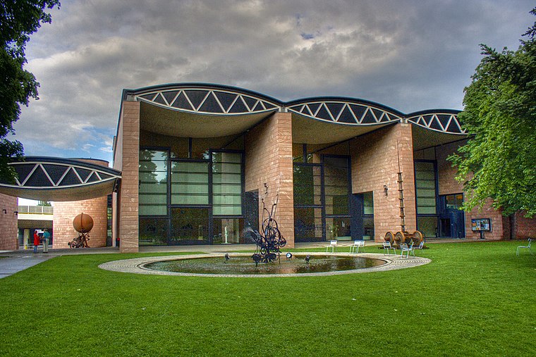
Photo: Alan Philip Müller, CC BY 2.0.
The Museum Tinguely is an art museum in Basel, Switzerland, dedicated to the work of Swiss painter and sculptor Jean Tinguely. Designed by architect Mario Botta, it opened in 1996 on the banks of the Rhine. Museum Tinguely is situated 1 km northwest of Birsfelden Birsstegweg.
Places in the Area
Nearby places include Birsfelden and Freidorf cooperative housing estate.
Birsfelden
Town

Photo: Wikimedia, CC BY-SA 3.0.
Birsfelden is a municipality in the district of Arlesheim in the canton of Basel-Country in Switzerland.
Freidorf cooperative housing estate
Neighborhood

Photo: Shaqspeare, CC BY-SA 3.0.
Freidorf cooperative housing estate is a neighborhood.

Birsfelden Birsstegweg
- Category: transportation
- Location: Basel, Basel-Stadt, Canton of Basel-City, Northwestern Switzerland, Switzerland, Central Europe, Europe
- View on OpenStreetMap
Latitude
47.55246° or 47° 33′ 9″ northLongitude
7.62189° or 7° 37′ 19″ eastOperator
MobilityOpen location code
8FV9HJ2C+XQOpenStreetMap ID
node 1996662821OpenStreetMap feature
amenity=car_sharing
This page is based on OpenStreetMap, Wikidata, and Wikimedia Commons.
We’d love your help improving our open data sources. Thank you for contributing.
Satellite Map
Discover Birsfelden Birsstegweg from above in high-definition satellite imagery.
Notable Places Nearby
Highlights include Bauernmarkt Birsfelden and Gemeindeverwaltung Birsfelden.
Nearby Places
Explore places such as Coop and k kiosk.
Northwestern Switzerland: Must-Visit Destinations
Delve into Liestal, Rheinfelden, and Augusta Raurica.
Curious Places to Discover
Uncover intriguing places from every corner of the globe.
About Mapcarta. Data © OpenStreetMap contributors and available under the Open Database License". Text is available under the CC BY-SA 4.0 license, except for photos, directions, and the map. Photo: Lucazzitto, CC BY-SA 3.0.