TUAZ - Rua Luis de Camões
TUAZ - Rua Luis de Camões is a bus stop in O. Azeméis, Riba-Ul, Ul, Macinhata da Seixa, Madail, Oliveira de Azeméis Municipality, Aveiro District. TUAZ - Rua Luis de Camões is situated nearby to the health club Element, as well as near the fountain Fonte Luminosa.| Tap on a place to explore it |
Places of Interest Nearby
Highlights include Oliveira de Azeméis railway station and Câmara Municipal de Oliveira de Azeméis.
Oliveira de Azeméis railway station
Railway station

Photo: JP Ribeiro, CC BY-SA 4.0.
Oliveira de Azeméis railway station is situated 240 metres northwest of TUAZ - Rua Luis de Camões.
Câmara Municipal de Oliveira de Azeméis
Town hall
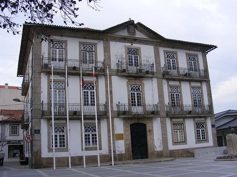
Photo: Piquito, Public domain.
Câmara Municipal de Oliveira de Azeméis is a town hall, which is situated 200 metres east of TUAZ - Rua Luis de Camões.
Estádio Carlos Osório
Stadium

Photo: HBrunoK, Public domain.
Estádio Carlos Osório is a stadium in Oliveira de Azeméis, Aveiro, Portugal. It is currently used for football matches and is the home ground of Liga de Honra side U.D. Estádio Carlos Osório is situated 1 km northeast of TUAZ - Rua Luis de Camões.
Places in the Area
Nearby places include Ul (Oliveira de Azeméis) and Travanca.
Ul (Oliveira de Azeméis)
Village

Photo: Vitor Oliveira, CC BY-SA 2.0.
Oliveira de Azeméis, Santiago de Riba-Ul, Ul, Macinhata da Seixa e Madail is a civil parish in the municipality of Oliveira de Azeméis in Porto Metropolitan Area, Portugal.
Travanca
Village

Photo: Wikimedia, CC BY-SA 4.0.
Travanca is a village, which is situated 2½ km south of TUAZ - Rua Luis de Camões.
Vila de Cucujães
Town

Photo: A14843, CC BY-SA 3.0.
Vila de Cucujães is a town, which is situated 4 km northwest of TUAZ - Rua Luis de Camões.
TUAZ - Rua Luis de Camões
Latitude
40.83852° or 40° 50′ 19″ northLongitude
-8.47991° or 8° 28′ 48″ westOpen location code
8CGHRGQC+C2OpenStreetMap ID
node 2006273840OpenStreetMap feature
highway=bus_stopOpenStreetMap feature
public_transport=platform
This page is based on OpenStreetMap, Wikidata, and Wikimedia Commons.
We’d love your help improving our open data sources. Thank you for contributing.
Satellite Map
Discover TUAZ - Rua Luis de Camões from above in high-definition satellite imagery.
Notable Places Nearby
Highlights include Element and Fonte Luminosa.
Nearby Places
Explore places such as Banco BPI and Pingo Doce.
Portugal: Must-Visit Destinations
Delve into Lisbon, Caldas da Rainha, Porto, and Coimbra.
Curious Bus Stops to Discover
Uncover intriguing bus stops from every corner of the globe.
About Mapcarta. Data © OpenStreetMap contributors and available under the Open Database License". Text is available under the CC BY-SA 4.0 license, except for photos, directions, and the map. Photo: Tsy1980, CC BY-SA 4.0.