日本同盟基督教団 名古屋福音伝道教会
日本同盟基督教団 名古屋福音伝道教会 is a church in Naka Ward, Nagoya, Aichi. 日本同盟基督教団 名古屋福音伝道教会 is situated nearby to the Shinto shrine Fuji Sengen Shrine, as well as near Osu Shopping Street.| Tap on a place to explore it |
Places of Interest Nearby
Highlights include Fuji Sengen Shrine and Osu Engeijo.
Fuji Sengen Shrine
Shinto shrine

Photo: Asturio Cantabrio, CC BY-SA 4.0.
The Fuji Sengen Shrine is a Shinto shrine located in Ōsu in central Nagoya, central Japan.
Osu Engeijo
Theater building
 Osu Engeijo is a theater building, which is situated 120 metres north of 日本同盟基督教団 名古屋福音伝道教会.
Osu Kannon
Buddhist temple
 Ōsu Kannon is a Buddhist temple of the Shingon sect located in Ōsu, in central Nagoya, Japan. It belongs to the Owari Thirty-three Kannon. Its address is 愛知県名古屋市中区大須2-21-47. Osu Kannon is situated 190 metres northwest of 日本同盟基督教団 名古屋福音伝道教会.
Places in the Area
Nearby places include Nishiki 3-chome and Nagoya Castle.
Nishiki 3-chome
Neighborhood

Photo: Akahito Yamabe, CC BY-SA 4.0.
Nishiki 3-chome is a neighborhood.
Nagoya Castle
Locality
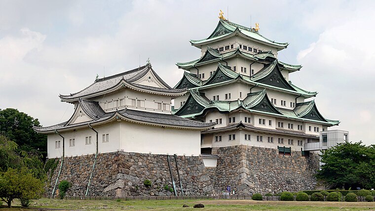
Photo: Base64, CC BY-SA 3.0.
Nagoya Castle is a Japanese castle located in Nagoya, Japan. Nagoya Castle was constructed by the Owari Domain in 1612 during the Edo period on the site of an earlier castle of the Oda clan in the Sengoku period. Nagoya Castle is situated 3 km north of 日本同盟基督教団 名古屋福音伝道教会.
Shōwa-ku
Suburb

Photo: Bariston, CC BY-SA 4.0.
Shōwa-ku is one of the 16 wards of the city of Nagoya in Aichi Prefecture, Japan. As of 1 October 2019, the ward had an estimated population of 110,436 and a population density of 10,095 persons per km². The total area was 10.94 km². Shōwa-ku is situated 3 km east of 日本同盟基督教団 名古屋福音伝道教会.
日本同盟基督教団 名古屋福音伝道教会
Latitude
35.15874° or 35° 9′ 32″ northLongitude
136.90092° or 136° 54′ 3″ eastOpen location code
8Q7R5W52+F9OpenStreetMap ID
node 2039457114OpenStreetMap feature
amenity=place_of_worship
This page is based on OpenStreetMap, Wikidata, and Wikimedia Commons.
We’d love your help improving our open data sources. Thank you for contributing.
Satellite Map
Discover 日本同盟基督教団 名古屋福音伝道教会 from above in high-definition satellite imagery.
Notable Places Nearby
Highlights include Osu Shopping Street and Noraya.
Nearby Places
Explore places such as 飲飲13 and OG.
Aichi: Must-Visit Destinations
Delve into Toyota, Toyohashi, Okazaki, and Ichinomiya.
Curious Churches to Discover
Uncover intriguing churches from every corner of the globe.
About Mapcarta. Data © OpenStreetMap contributors and available under the Open Database License". Text is available under the CC BY-SA 4.0 license, except for photos, directions, and the map. Photo: Wikimedia, CC BY 2.0.