Bosc dels Canonges
Bosc dels Canonges is a locality in Os de Balaguer, Lleida, Catalonia. Bosc dels Canonges is situated nearby to the locality Sort dels Canonges, as well as near Bosc del Valeriano.| Tap on a place to explore it |
Places of Interest
Highlights include Malera and Sant Miquel de Tartareu.

Sant Miquel de Tartareu
Church
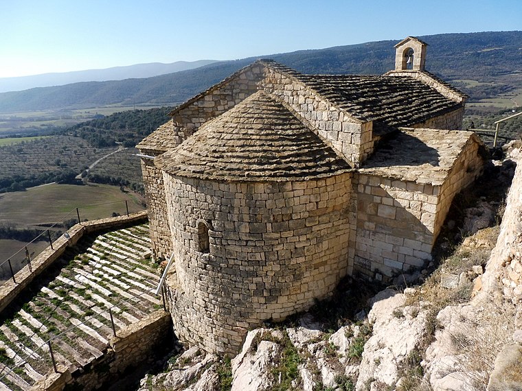
Photo: Isidre blanc, CC BY-SA 4.0.
Sant Miquel de Tartareu is a church.
Santa Maria de Tartareu
Church

Photo: Isidre blanc, CC BY-SA 4.0.
Santa Maria de Tartareu is a church.
Places in the Area
Nearby places include Vilamajor and Tartareu.


Les Avellanes i Santa Linya
Village

Photo: Fotoarxiu.sarratetorres, CC BY-SA 3.0.
Les Avellanes i Santa Linya is a municipality in the comarca of Noguera, in the province of Lleida, Catalonia, Spain. It has a population of 430. The municipality was formed in 1970 after the merger of Les Avellanes, Santa Linya, Tartareu and Vilanova de la Sal. Les Avellanes i Santa Linya is situated 3½ km southeast of Bosc dels Canonges.
Bosc dels Canonges
- Type: Locality
- Location: Os de Balaguer, Lleida, Catalonia, Eastern Spain, Spain, Iberia, Europe
- View on OpenStreetMap
Latitude
41.93076° or 41° 55′ 51″ northLongitude
0.73993° or 0° 44′ 24″ eastOpen location code
8FH2WPJQ+8XOpenStreetMap ID
node 2056802308OpenStreetMap feature
place=locality
This page is based on OpenStreetMap, Wikidata, and Wikimedia Commons.
We’d love your help improving our open data sources. Thank you for contributing.
Satellite Map
Discover Bosc dels Canonges from above in high-definition satellite imagery.
In Other Languages
“Bosc dels Canonges” goes by many names.
- Catalan: “Bosc dels Canonges”
Localities in the Area
Explore places such as Sort dels Canonges and Bosc del Valeriano.
Notable Places Nearby
Highlights include Font del Saüc and Pou del Barranc.
Lleida: Must-Visit Destinations
Delve into Lleida, Val d’Aran, La Seu d’Urgell, and Aigüestortes i Estany de Sant Maurici National Park.
Curious Localities to Discover
Uncover intriguing localities from every corner of the globe.
About Mapcarta. Data © OpenStreetMap contributors and available under the Open Database License". Text is available under the CC BY-SA 4.0 license, except for photos, directions, and the map. Photo: Wikimedia, CC0.