Le Mas de Marrou
Le Mas de Marrou is a hamlet in Peyrusse-le-Roc, Arrondissement of Villefranche-de-Rouergue, Occitanie. Le Mas de Marrou is situated nearby to the hamlet Le Mas de Marty, as well as near Peyrator.| Tap on a place to explore it |
- Type: Hamlet
- Address: GALGAN, 12220
- Postal code: 12220
Places of Interest
Highlights include Église Saint-Michel de Pachins and Château Inférieur.
Église Saint-Michel de Pachins
Church

Photo: WCOMFR, CC BY-SA 4.0.
Église Saint-Michel de Pachins is a church.
Château Inférieur
Castle

Photo: Campels, CC BY-SA 4.0.
The Château Inférieur is a ruined castle in the commune of Peyrusse-le-Roc in the Aveyron département of France. Peyrusse-le-Roc was known during Roman times for the richness of its silver, lead and antimony mines. Château Inférieur is situated 3 km northwest of Le Mas de Marrou.
Église Notre-Dame de Drulhe
Church

Photo: Ikmo-ned, CC BY-SA 4.0.
Église Notre-Dame de Drulhe is a church, which is situated 3 km southwest of Le Mas de Marrou.
Places in the Area
Nearby places include Montbazens and Valzergues.
Montbazens
Village

Photo: Thérèse Gaigé, CC BY-SA 3.0.
Montbazens is a commune in the Aveyron department in southern France. Montbazens is situated 5 km east of Le Mas de Marrou.
Valzergues
Village
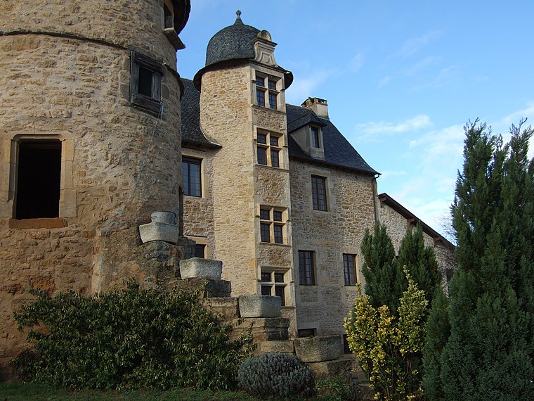
Photo: Wikimedia, CC BY-SA 3.0.
Valzergues is a commune in the Aveyron department in southern France. Valzergues is situated 6 km northeast of Le Mas de Marrou.
Sonnac
Village

Photo: WCOMFR, CC BY-SA 4.0.
Sonnac is a commune in the Aveyron department in southern France. Sonnac is situated 9 km northwest of Le Mas de Marrou.
Le Mas de Marrou
- Category: locality
- Location: Peyrusse-le-Roc, Arrondissement of Villefranche-de-Rouergue, Aveyron, Occitanie, France, Europe
- View on OpenStreetMap
Latitude
44.47458° or 44° 28′ 29″ northLongitude
2.16077° or 2° 9′ 39″ eastOpen location code
8FP4F5F6+R8OpenStreetMap ID
node 2103425467OpenStreetMap feature
place=hamlet
This page is based on OpenStreetMap, Wikidata, and Wikimedia Commons.
We’d love your help improving our open data sources. Thank you for contributing.
Satellite Map
Discover Le Mas de Marrou from above in high-definition satellite imagery.
Localities in the Area
Explore places such as Le Mas de Marty and Peyrator.
Notable Places Nearby
Highlights include Salle des Fêtes and Aire de Camping-car Peyrusse-le-Roc.
Curious Hamlets to Discover
Uncover intriguing hamlets from every corner of the globe.
About Mapcarta. Data © OpenStreetMap contributors and available under the Open Database License". Text is available under the CC BY-SA 4.0 license, except for photos, directions, and the map. Photo: Inkey, Public domain.