Sportboothafen Zempin
Sportboothafen Zempin is a marina in Koserow, Vorpommern-Greifswald, Mecklenburg-Western Pomerania. Sportboothafen Zempin is situated nearby to the museum Atelier Otto Niemeyer-Holstein, Lüttenort, Usedom, as well as near the movie theater Autokino Koserow.| Tap on a place to explore it |
Places of Interest Nearby
Highlights include Atelier Otto Niemeyer-Holstein, Lüttenort, Usedom and Streckelsberg.
Atelier Otto Niemeyer-Holstein, Lüttenort, Usedom
Museum

Photo: Sr. F, Public domain.
Atelier Otto Niemeyer-Holstein, Lüttenort, Usedom is a museum.
Streckelsberg
Peak

Photo: Wikimedia, CC BY-SA 4.0.
The Streckelsberg is an approximately 58-metre high coastal cliff on the island of Usedom in North Germany. After the Golm and the Kückelsberg, the Streckelsberg is the third highest elevation on the island. Streckelsberg is situated 3 km southeast of Sportboothafen Zempin.
Koserow church
Church

Photo: Unukorno, CC BY-SA 3.0.
Koserow church is situated 2½ km southeast of Sportboothafen Zempin.
Places in the Area
Nearby places include Zempin and Koelpinsee.
Zempin
Village

Photo: Niteshift, CC BY-SA 3.0.
Zempin is a German municipality and the smallest seaside resort on Usedom island. It lies between Zinnowitz and Koserow on the narrowest part of the island, between the Baltic Sea and the Achterwasser, a bay of the Oder Lagoon.
Koelpinsee
Village

Photo: InselUsedom2022, CC BY-SA 4.0.
Koelpinsee is a village, which is situated 4½ km southeast of Sportboothafen Zempin.
Zinnowitz
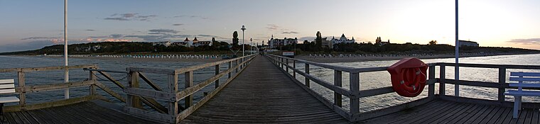
Photo: Dirk Vorderstraße, CC BY 2.0.
Zinnowitz is a sea-bath resort town on the island of Usedom. As Germany's sunniest place, it attracts holidaymakers from near and far.
Sportboothafen Zempin
- Type: Marina
- Categories: recreation area and transportation
- Location: Koserow, Vorpommern-Greifswald, Mecklenburg-Western Pomerania, Germany, Central Europe, Europe
- View on OpenStreetMap
Latitude
54.06384° or 54° 3′ 50″ northLongitude
13.97501° or 13° 58′ 30″ eastOpen location code
9F6M3X7G+G2OpenStreetMap ID
node 2132320954OpenStreetMap feature
leisure=marina
This page is based on OpenStreetMap, Wikidata, and Wikimedia Commons.
We’d love your help improving our open data sources. Thank you for contributing.
Satellite Map
Discover Sportboothafen Zempin from above in high-definition satellite imagery.
Notable Places Nearby
Highlights include Autokino Koserow and Wohnmobil Stellplatz Koserow.
Nearby Places
Explore places such as Lüttenort and Forsthaus Damerow.
Mecklenburg-Western Pomerania: Must-Visit Destinations
Delve into Schwerin, Rostock, Wismar, and Stralsund.
Curious Marinas to Discover
Uncover intriguing marinas from every corner of the globe.
About Mapcarta. Data © OpenStreetMap contributors and available under the Open Database License". Text is available under the CC BY-SA 4.0 license, except for photos, directions, and the map. Photo: Schiwago, CC BY 2.5.