Weixelbaum Ort
Weixelbaum Ort is a bus stop in Deutsch Goritz, Südoststeiermark District, Styria. Weixelbaum Ort is situated nearby to the fire station Freiwillige Feuerwehr Weixelbaum, as well as near the playground Fußballplatz Weixelbaum.| Tap on a place to explore it |
Places of Interest Nearby
Highlights include Ortskapelle Mariahilf and Meinlmühle.
Ortskapelle Mariahilf
Chapel

Photo: Herzi Pinki, CC BY-SA 3.0 at.
Ortskapelle Mariahilf is a chapel, which is situated 1¼ km southeast of Weixelbaum Ort.
Meinlmühle

Photo: E.mil.mil, CC BY-SA 3.0 at.
Meinlmühle is situated 1¼ km southeast of Weixelbaum Ort.
Ortskapelle Oberpurkla
Church
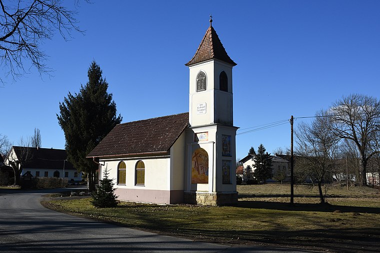
Photo: Iswoar, CC BY-SA 4.0.
Ortskapelle Oberpurkla is a church, which is situated 2½ km east of Weixelbaum Ort.
Places in the Area
Nearby places include Ratschendorf and Žepovci.
Ratschendorf
Village

Photo: Christian Pirkl, CC BY-SA 4.0.
Ratschendorf is a former municipality in the district of Südoststeiermark in the Austrian state of Styria. Since the 2015 Styria municipal structural reform, it is part of the municipality Deutsch Goritz. Ratschendorf is situated 4 km west of Weixelbaum Ort.
Žepovci
Village
Žepovci is a village in the Municipality of Apače in northeastern Slovenia. The village chapel with a belfry over its entrance is dedicated to the Virgin Mary. It was built in the second half of the 19th century, with the belfry rebuilt at a later date. Žepovci is situated 4½ km south of Weixelbaum Ort.
Žiberci
Village
Žiberci is a village in the Municipality of Apače in northeastern Slovenia. There is a 19th-century two-storey belfry in the village. Žiberci is situated 4½ km south of Weixelbaum Ort.
Weixelbaum Ort
- Type: Bus stop
- Also known as: “Weixelbaum Kaufhaus Palz”
- Category: transportation
- Location: Deutsch Goritz, Südoststeiermark District, Styria, Austria, Central Europe, Europe
- View on OpenStreetMap
Latitude
46.73612° or 46° 44′ 10″ northLongitude
15.86902° or 15° 52′ 9″ eastOpen location code
8FRQPVP9+CJOpenStreetMap ID
node 2132563674OpenStreetMap feature
highway=bus_stopOpenStreetMap feature
public_transport=platform
This page is based on OpenStreetMap, Wikidata, and Wikimedia Commons.
We’d love your help improving our open data sources. Thank you for contributing.
Satellite Map
Discover Weixelbaum Ort from above in high-definition satellite imagery.
Notable Places Nearby
Highlights include Freiwillige Feuerwehr Weixelbaum and Fußballplatz Weixelbaum.
Nearby Places
Explore places such as Weixelbaum Ort and Colortec Pulverbeschichtungs GmbH.
Styria: Must-Visit Destinations
Delve into Graz, Leoben, Bruck an der Mur, and Kapfenberg.
Curious Bus Stops to Discover
Uncover intriguing bus stops from every corner of the globe.
About Mapcarta. Data © OpenStreetMap contributors and available under the Open Database License". Text is available under the CC BY-SA 4.0 license, except for photos, directions, and the map. Photo: Kmarka, CC BY-SA 3.0.