Tunjice trg.
Tunjice trg. is a bus stop in Municipality of Kamnik, Slovenia. Tunjice trg. is situated nearby to the hamlet Košiše, as well as near Tunjiška Mlaka.| Tap on a place to explore it |
Places of Interest Nearby
Highlights include St. Anne’s Church (Tunjice) and Zaprice Castle.
St. Anne’s Church (Tunjice)
Church

Photo: Ljuba brank, CC BY-SA 3.0.
St. Anne’s Church (Tunjice) is situated 1 km west of Tunjice trg..
Zaprice Castle
Castle
 Zaprice Castle is a castle in Zaprice, now part of the town of Kamnik, Slovenia. The castle was first indirectly mentioned in 1306 and was originally built in the 14th century by the Dienger von Apecz family. Zaprice Castle is situated 2 km southeast of Tunjice trg..
Kamnik railway station
Railway station
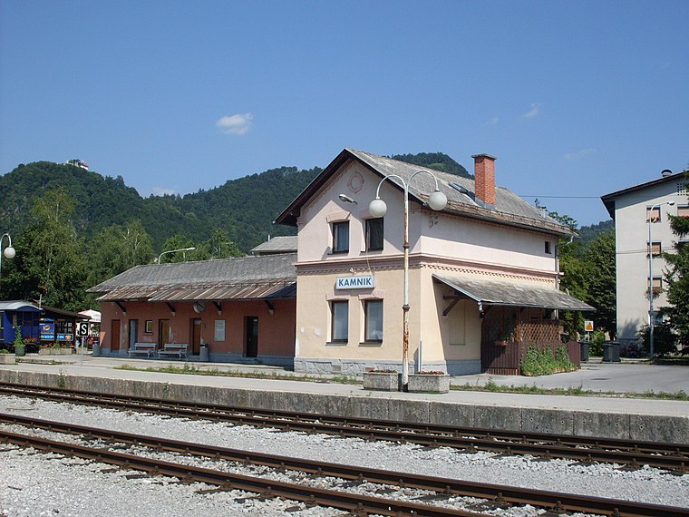
Photo: Ajznponar, CC BY-SA 3.0.
Kamnik railway station is situated 2 km southeast of Tunjice trg..
Places in the Area
Nearby places include Košiše and Tunjiška Mlaka.
Košiše
Hamlet

Photo: Doremo, CC BY-SA 4.0.
Košiše is a small dispersed settlement above Mekinje in the Municipality of Kamnik in the Upper Carniola region of Slovenia. The settlement includes the hamlet of Ravne.
Tunjiška Mlaka
Hamlet

Photo: Doremo, CC BY-SA 4.0.
Tunjiška Mlaka is a dispersed settlement next to Tunjice in the Tunjice Hills west of the town of Kamnik in Upper Carniola region of Slovenia.
Tunjice
Village

Photo: Doremo, CC BY-SA 4.0.
Tunjice is a dispersed settlement in the Tunjice Hills west of the town of Kamnik in Upper Carniola region of Slovenia. In the forest close to the church a "natural healing grove" with several "energy springs," known as the Tunjice Natural Health Resort, has been established.
Tunjice trg.
- Type: Bus stop
- Category: transportation
- Location: Municipality of Kamnik, Slovenia, Central Europe, Europe
- View on OpenStreetMap
Latitude
46.23426° or 46° 14′ 3″ northLongitude
14.58797° or 14° 35′ 17″ eastOpen location code
8FRP6HMQ+P5OpenStreetMap ID
node 2262126493OpenStreetMap feature
highway=bus_stopOpenStreetMap feature
public_transport=platform
This page is based on OpenStreetMap, Wikidata, and Wikimedia Commons.
We’d love your help improving our open data sources. Thank you for contributing.
Satellite Map
Discover Tunjice trg. from above in high-definition satellite imagery.
Notable Places Nearby
Highlights include Pokopališče Tunjice and PGD Tunjice.
Nearby Places
Explore places such as Tunjice trg. and Gostilna in Picerija za Tunco.
Slovenia: Must-Visit Destinations
Delve into Ljubljana, Maribor, Koper, and Celje.
Curious Bus Stops to Discover
Uncover intriguing bus stops from every corner of the globe.
About Mapcarta. Data © OpenStreetMap contributors and available under the Open Database License". Text is available under the CC BY-SA 4.0 license, except for photos, directions, and the map. Photo: Jjtkk, CC BY 3.0.