Adventure Park Färich
Adventure Park Färich is a theme park in Davos, Graubünden. Adventure Park Färich is situated nearby to the playground Spielplatz Färich, as well as near AlpenGold Hotel Davos.| Tap on a place to explore it |
Places of Interest Nearby
Highlights include AlpenGold Hotel Davos and Lake Davos.
AlpenGold Hotel Davos
Hotel
 The AlpenGold Hotel, formerly branded as InterContinental, is a luxury hotel located in Davos, Switzerland. Opened in 2013 to serve as a vacation and business resort in the Grison Alps, it was managed under the brand InterContinental until 2021, one of the world's major luxury hotel and resort brands. AlpenGold Hotel Davos is situated 310 metres north of Adventure Park Färich.
Lake Davos
Lake
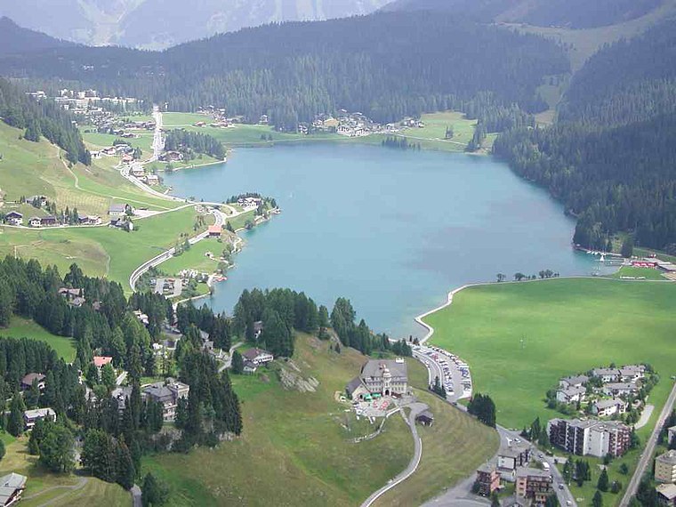
Photo: Flyout, CC BY-SA 3.0.
Lake Davos is a small natural lake at Davos, Switzerland. Its surface area is 0.59 km² and the maximum depth is 54 m. Fed by sources of the Rhine, Flüelabach and Totalpbach, among other mountain creeks, the lake is used as a hydropower reservoir; its water no longer flows to the river Landwasser but is channeled into the river Landquart at Klosters.
Davos Dorf Railway Station
Railway station

Photo: Havang(nl), CC0.
Davos Dorf railway station is a railway station in the municipality of Davos, in the Swiss canton of Grisons. It is an intermediate stop on the 1,000 mm metre gauge Landquart–Davos Platz line of the Rhaetian Railway. Davos Dorf Railway Station is situated 1 km west of Adventure Park Färich.
Places in the Area
Nearby places include Davos Platz and Davos Frauenkirch.
Davos Platz
Suburb

Photo: MadGeographer, CC BY-SA 3.0.
Davos is an Alpine resort town and municipality in the Prättigau/Davos Region in the canton of the Grisons, Switzerland. It has a permanent population of 10,832. Davos Platz is situated 3½ km southwest of Adventure Park Färich.
Davos Frauenkirch
Hamlet
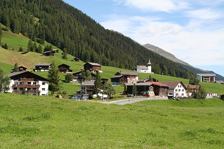
Photo: Parpan05, CC BY-SA 3.0.
Davos Frauenkirch is a hamlet, which is situated 6 km southwest of Adventure Park Färich.
Klosters

Photo: Patrick Nouhailler’s…, CC BY-SA 3.0.
Klosters is a Swiss village in the Prättigau, politically part of the municipality of Klosters-Serneus, which belongs to the political district Prättigau/Davos in the canton of Grisons.
Adventure Park Färich
- Email: adventurepark@davos.gr.ch
- Type: Theme park
- Categories: tourism, recreation area, and tourist attraction
- Location: Davos, Region Prättigau / Davos, Graubünden, Switzerland, Central Europe, Europe
- View on OpenStreetMap
Latitude
46.81075° or 46° 48′ 39″ northLongitude
9.85511° or 9° 51′ 18″ eastOpen location code
8FRFRV64+72OpenStreetMap ID
node 2280534413OpenStreetMap feature
leisure=Bike_Park, ropes_courseOpenStreetMap feature
tourism=theme_park
This page is based on OpenStreetMap, Wikidata, and Wikimedia Commons.
We’d love your help improving our open data sources. Thank you for contributing.
Satellite Map
Discover Adventure Park Färich from above in high-definition satellite imagery.
Notable Places Nearby
Highlights include Spielplatz Färich and Adventure Park Färich.
Nearby Places
Explore places such as Chalet Velo and Parkplatz Färich.
Graubünden: Must-Visit Destinations
Delve into Chur, St. Moritz, Arosa, and Klosters.
Curious Theme Parks to Discover
Uncover intriguing theme parks from every corner of the globe.
About Mapcarta. Data © OpenStreetMap contributors and available under the Open Database License". Text is available under the CC BY-SA 4.0 license, except for photos, directions, and the map. Photo: Flyout, CC BY-SA 3.0.