Untere Bilsteinklippe
Untere Bilsteinklippe is a peak in Bad Wildungen, Waldeck-Frankenberg, Hesse and has an elevation of 353 metres. Untere Bilsteinklippe is situated nearby to the village Reitzenhagen, as well as near the locality Hinter´m tiefen Graben.| Tap on a place to explore it |
Places of Interest
Highlights include Schloss Friedrichstein and Homberg Observation Tower.
Schloss Friedrichstein
Castle
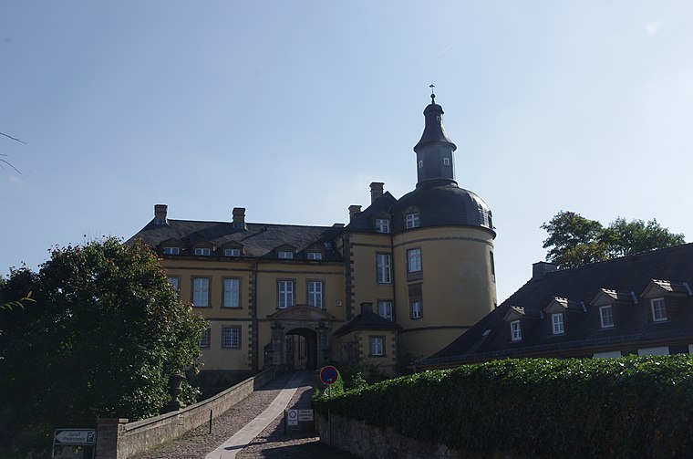
Photo: Clemensfranz, CC BY-SA 3.0.
Schloss Friedrichstein is a castle.
Homberg Observation Tower
Scenic viewpoint

Photo: Dirk Schmidt, CC BY-SA 3.0.
Homberg Observation Tower is a scenic viewpoint.
Places in the Area
Nearby places include Hemfurth-Edersee.

Untere Bilsteinklippe
- Type: Peak with an elevation of 353 metres
- Category: landform
- Location: Bad Wildungen, Waldeck-Frankenberg, Kassel, Hesse, Germany, Central Europe, Europe
- View on OpenStreetMap
Latitude
51.1275° or 51° 7′ 39″ northLongitude
9.0965° or 9° 5′ 47″ eastElevation
353 metres (1,158 feet)Open location code
9F3F43HW+2JOpenStreetMap ID
node 2285354854OpenStreetMap feature
natural=peak
This page is based on OpenStreetMap, Wikidata, and Wikimedia Commons.
We’d love your help improving our open data sources. Thank you for contributing.
Satellite Map
Discover Untere Bilsteinklippe from above in high-definition satellite imagery.
Localities in the Area
Explore places such as Reitzenhagen and Hinter´m tiefen Graben.
Notable Places Nearby
Highlights include Bilsteinklippen and Bilsteinwiesen.
Hesse: Must-Visit Destinations
Delve into Frankfurt, Wiesbaden, Darmstadt, and Kassel.
Curious Peaks to Discover
Uncover intriguing peaks from every corner of the globe.
About Mapcarta. Data © OpenStreetMap contributors and available under the Open Database License". Text is available under the CC BY-SA 4.0 license, except for photos, directions, and the map. Photo: Pedelecs, CC BY-SA 3.0.