JUFA Hotel Gitschtal***
JUFA Hotel Gitschtal*** is a hotel in Carinthia, Austria. JUFA Hotel Gitschtal*** is situated nearby to the reservoir Speicher für Beschneiung, as well as near the post office Postpartner 9622, Glitschtal Reisen Wastian.| Tap on a place to explore it |
- Email: gitschtal@jufahotels.com
- Type: Hotel
- Address: 266, Weißbriach, Weißbriach, 9622
Places of Interest Nearby
Highlights include Kreuzberg Saddle and Hühnernock.
Kreuzberg Saddle
Mountain saddle
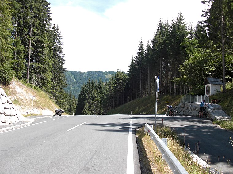
Photo: Ulflulfl, Public domain.
Kreuzberg Saddle is a high mountain pass across the Gailtal Alps in the Austrian state of Carinthia. The 1,074 m high pass is part of the B 87 Weißensee Straße highway connecting the market town of Greifenburg in the Drava valley with Gitschtal and the district capital Hermagor on the Gail river. Kreuzberg Saddle is situated 3 km north of JUFA Hotel Gitschtal***.
Hühnernock
Peak

Photo: Joadl, CC BY-SA 3.0 at.
Hühnernock is a peak, which is situated 3 km northeast of JUFA Hotel Gitschtal***.
Mittagsnock
Peak
Photo: Hangman’sDeath, CC0.
Mittagsnock is a peak, which is situated 3½ km east of JUFA Hotel Gitschtal***.
Places in the Area
Nearby places include Rattendorf and Tröpolach.
Rattendorf
Village

Photo: Codas, CC BY-SA 4.0.
Rattendorf is a village, which is situated 7 km south of JUFA Hotel Gitschtal***.
Tröpolach
Village

Photo: Pnapora, CC BY-SA 4.0.
Tröpolach is a village, which is situated 8 km south of JUFA Hotel Gitschtal***.
Watschig
Village

Photo: Johann Jaritz, CC BY-SA 4.0.
Watschig is a village, which is situated 8 km southeast of JUFA Hotel Gitschtal***.
JUFA Hotel Gitschtal***
- Categories: tourism, accommodation, and building
- Location: Carinthia, Austria, Central Europe, Europe
- View on OpenStreetMap
Latitude
46.68246° or 46° 40′ 57″ northLongitude
13.24303° or 13° 14′ 35″ eastOperator
JUFA Hotels Österreich GmbHOpen location code
8FRMM6JV+X6OpenStreetMap ID
node 2316951467OpenStreetMap feature
tourism=hotel
This page is based on OpenStreetMap, Wikidata, and Wikimedia Commons.
We’d love your help improving our open data sources. Thank you for contributing.
Satellite Map
Discover JUFA Hotel Gitschtal*** from above in high-definition satellite imagery.
Notable Places Nearby
Highlights include Jufa Hotel Gitschtal and Speicher für Beschneiung.
Nearby Places
Explore places such as Weissbriach Süd JUFA and Haus Holunder.
Carinthia: Must-Visit Destinations
Delve into Klagenfurt, Villach, Wörthersee, and Spittal an der Drau.
Curious Hotels to Discover
Uncover intriguing hotels from every corner of the globe.
About Mapcarta. Data © OpenStreetMap contributors and available under the Open Database License". Text is available under the CC BY-SA 4.0 license, except for photos, directions, and the map. Photo: Wikimedia, CC BY-SA 3.0.