Frellsens Chokolade
Frellsens Chokolade is a confectionery store in Slagelse Municipality, Region Zealand. Frellsens Chokolade is situated nearby to the shopping center VestsjællandsCentret, as well as near the town hall Slagelse Rådhus.| Tap on a place to explore it |
Places of Interest Nearby
Highlights include VestsjællandsCentret and Slagelse railway station.
VestsjællandsCentret
Shopping center
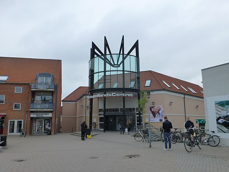
Photo: Dannebrog Spy, CC BY-SA 4.0.
VestsjællandsCentret is a shopping center.
Slagelse railway station
Railway station

Photo: Wikimedia, CC BY-SA 3.0.
Slagelse railway station is the main railway station serving the town of Slagelse in southwestern Zealand, Denmark. It is located in the centre of the town, on the northern edge of the historic town centre, and immediately adjacent to the Slagelse bus station. Slagelse railway station is situated 420 metres northwest of Frellsens Chokolade.
Church of Our Lady
Church

Photo: Wikimedia, Public domain.
Church of Our Lady is situated 230 metres southwest of Frellsens Chokolade.
Places in the Area
Nearby places include Slagelse and Slots Bjergby.
Slagelse

Photo: Toxophilus, CC BY-SA 4.0.
Slagelse is a town on Zealand, Denmark. The town is the seat of Slagelse Municipality, and is the biggest town of the municipality. It is located 15 km east of Korsør, 16 km north-east of Skælskør, 33 km south-east of Kalundborg and 14 km west of Sorø.
Slots Bjergby
Village

Photo: Jens Cederskjold, CC BY-SA 2.0.
Slots Bjergby is a small town in Zealand, Denmark. It is located in Slagelse Municipality. Slots Bjergby is situated 4 km south of Frellsens Chokolade.
Havrebjerg
Village

Photo: Bococo, CC BY-SA 3.0.
Havrebjerg is a village on Zealand, Denmark. It is located in Slagelse Municipality. Havrebjerg is situated 5 km northwest of Frellsens Chokolade.
Frellsens Chokolade
- Type: Confectionery store
- Categories: shop and food
- Location: Slagelse Municipality, Region Zealand, Denmark, Nordic countries, Europe
- View on OpenStreetMap
Latitude
55.40593° or 55° 24′ 21″ northLongitude
11.3546° or 11° 21′ 17″ eastOperator
FrellsenOpen location code
9F7HC943+9ROpenStreetMap ID
node 2318851468OpenStreetMap feature
shop=confectionery
This page is based on OpenStreetMap, Wikidata, and Wikimedia Commons.
We’d love your help improving our open data sources. Thank you for contributing.
Satellite Map
Discover Frellsens Chokolade from above in high-definition satellite imagery.
Places with the Same Name
Discover other places named “Frellsens Chokolade”.
Notable Places Nearby
Highlights include Slagelse Rådhus and PureGym.
Nearby Places
Explore places such as Søstrene Grene Slagelse and Mayo.
Denmark: Must-Visit Destinations
Delve into Copenhagen, Aarhus, Odense, and Aalborg.
Curious Confectionery Stores to Discover
Uncover intriguing confectionery stores from every corner of the globe.
About Mapcarta. Data © OpenStreetMap contributors and available under the Open Database License". Text is available under the CC BY-SA 4.0 license, except for photos, directions, and the map. Photo: Inkey, CC BY 2.0.