Schneiderei Le
Schneiderei Le is a tailor shop in Berlin, Berlin which is located on Albrechtstraße. Schneiderei Le is situated nearby to the sports venue 1. Berliner Kinder-Schwimmschule, as well as near the arts center Lit Korea.| Tap on a place to explore it |
- Opening hours:
Monday—Friday: 9:00 AM—7:00 PM
Saturday: 9:00 AM—5:00 PM - Type: Tailor shop
- Address: Albrechtstraße 111, Steglitz, Berlin, 12167
- Wheelchair access: yes
Places of Interest Nearby
Highlights include Dreieinigkeitskirche and Rathaus Steglitz.
Dreieinigkeitskirche
Church

Photo: Bodo Kubrak, CC0.
Dreieinigkeitskirche is a church, which is situated 280 metres northeast of Schneiderei Le.
Rathaus Steglitz
Government building
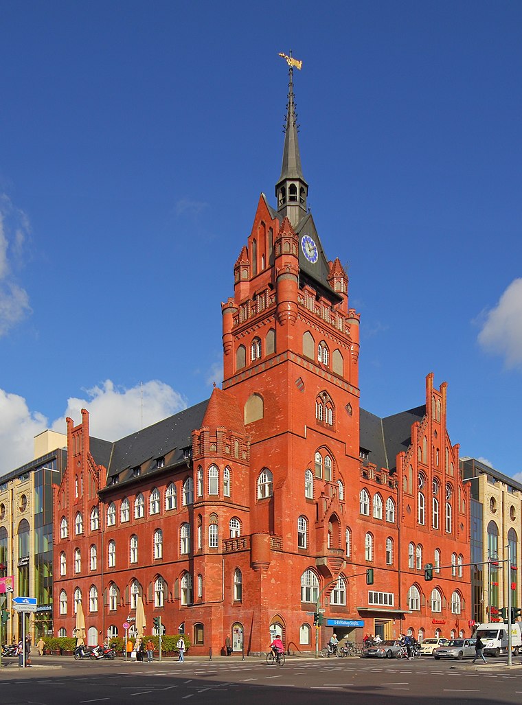
Photo: A.Savin, CC BY-SA 3.0.
Rathaus Steglitz is a government building, which is situated 610 metres northwest of Schneiderei Le.
Berlin Rathaus Steglitz station
Railway stop

Photo: Muns, CC BY-SA 3.0.
Berlin Rathaus Steglitz is the name of both a railway station on the Wannsee Railway and a U-Bahn station in the district of Steglitz in Berlin, Germany, which are close together. Berlin Rathaus Steglitz station is situated 410 metres west of Schneiderei Le.
Places in the Area
Nearby places include Künstlerkolonie and Lichterfelde.

Lichterfelde
Suburb

Photo: Fridolin freudenfett, CC BY-SA 3.0.
Lichterfelde is a locality in the borough of Steglitz-Zehlendorf in Berlin, Germany. Until 2001 it was part of the former borough of Steglitz, along with Steglitz and Lankwitz.
Rote Insel
Quarter
Rote Insel is the name colloquially given to a neighborhood in the Schöneberg district of the German capital, Berlin. As such, the neighborhood is part of Berlin's 7th administrative borough, Tempelhof-Schöneberg. Rote Insel is situated 4 km northeast of Schneiderei Le.
Schneiderei Le
- Category: shop
- Location: Berlin, Berlin, Stadt, Berlin, Germany, Central Europe, Europe
- View on OpenStreetMap
Latitude
52.45448° or 52° 27′ 16″ northLongitude
13.32832° or 13° 19′ 42″ eastOpen location code
9F4MF83H+Q8OpenStreetMap ID
node 2327208859OpenStreetMap feature
shop=tailorOpenStreetMap attribute
wheelchair=yes
This page is based on OpenStreetMap, Wikidata, and Wikimedia Commons.
We’d love your help improving our open data sources. Thank you for contributing.
Satellite Map
Discover Schneiderei Le from above in high-definition satellite imagery.
Notable Places Nearby
Highlights include 1. Berliner Kinder-Schwimmschule and Christi Himmelfahrt Kirche.
Nearby Places
Explore places such as Grieneisen and Plantagenstr..
Berlin: Must-Visit Destinations
Delve into Mitte, East Central, City West, and East Berlin.
Curious Places to Discover
Uncover intriguing places from every corner of the globe.
About Mapcarta. Data © OpenStreetMap contributors and available under the Open Database License". Text is available under the CC BY-SA 4.0 license, except for photos, directions, and the map. Photo: Berthold Werner, CC BY-SA 3.0.