Private Wetterstation
Private Wetterstation is a monitoring station in Donaueschingen, Schwarzwald-Baar-Kreis, Baden-Württemberg. Private Wetterstation is situated nearby to the community center Turn- und Festhalle, as well as near the church Friedhofskapelle.| Tap on a place to explore it |
Places of Interest Nearby
Highlights include Burg Entenburg and St. Andreas.
Burg Entenburg
Castle
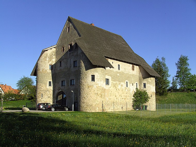
Photo: Roland Nonnenmacher, CC BY-SA 3.0.
Burg Entenburg is a castle, which is situated 400 metres west of Private Wetterstation.
St. Andreas
Church

Photo: Llez, CC BY-SA 3.0.
St. Andreas is a church, which is situated 3 km south of Private Wetterstation.
Places in the Area
Nearby places include Pfohren and Neudingen.

Neudingen
Village

Photo: Llez, CC BY-SA 3.0.
Neudingen is a village, which is situated 3 km south of Private Wetterstation.
Hüfingen
Town

Photo: Spotter2, CC BY-SA 3.0.
Hüfingen is a town in the district of Schwarzwald-Baar, in Baden-Württemberg, Germany. It is situated on the river Breg, 4 km south of the source of the Danube. Hüfingen is situated 5 km west of Private Wetterstation.
Private Wetterstation
Latitude
47.9369° or 47° 56′ 13″ northLongitude
8.55721° or 8° 33′ 26″ eastOpen location code
8FVCWHP4+QVOpenStreetMap ID
node 2327354085OpenStreetMap feature
man_made=monitoring_station
This page is based on OpenStreetMap, Wikidata, and Wikimedia Commons.
We’d love your help improving our open data sources. Thank you for contributing.
Satellite Map
Discover Private Wetterstation from above in high-definition satellite imagery.
Notable Places Nearby
Highlights include Turn- und Festhalle and Friedhofskapelle.
Nearby Places
Explore places such as Ortsmitte and Grundschule Pfohren.
Baden-Württemberg: Must-Visit Destinations
Delve into Stuttgart, Heidelberg, Karlsruhe, and Mannheim.
Curious Monitoring Stations to Discover
Uncover intriguing monitoring stations from every corner of the globe.
About Mapcarta. Data © OpenStreetMap contributors and available under the Open Database License". Text is available under the CC BY-SA 4.0 license, except for photos, directions, and the map. Photo: Ymblanter, CC BY-SA 4.0.