Les Pâles-Plan Cerisier
Les Pâles-Plan Cerisier is a hamlet in Martigny-Combe, Martigny District, Valais. Les Pâles-Plan Cerisier is situated nearby to the hamlet Le Perrey, as well as near La Crette.| Tap on a place to explore it |
Places of Interest
Highlights include Martigny-Croix railway station and Saint-Jean chapel.
Martigny-Croix railway station
Railway stop
 Martigny-Croix railway station is a railway station in the municipality of Martigny, in the Swiss canton of Valais. It is an intermediate stop and a request stop on the standard gauge Martigny–Orsières line of Transports de Martigny et Régions.

Fondation Pierre Gianadda

Photo: Sylenius, CC BY-SA 3.0.
Fondation Pierre Gianadda, inaugurated in 1978, administers museums and exhibitions located in Martigny, Switzerland. The permanent exhibitions include the Automobile Museum, Gallo-Roman Museum, Louis and Evelyn Franck Collection, Sculpture Park, and Chagall Court.
Places in the Area
Nearby places include Martigny and Gorges du Durnand.
Martigny
 Martigny is a town in the French-speaking part of Valais. It lies in the Rhone valley and is one of the economic centres of the region.
Gorges du Durnand
Locality

Photo: Gaelbourgeois, CC BY-SA 4.0.
Gorges du Durnand is a locality, which is situated 2½ km southeast of Les Pâles-Plan Cerisier.
Bovernier
Village
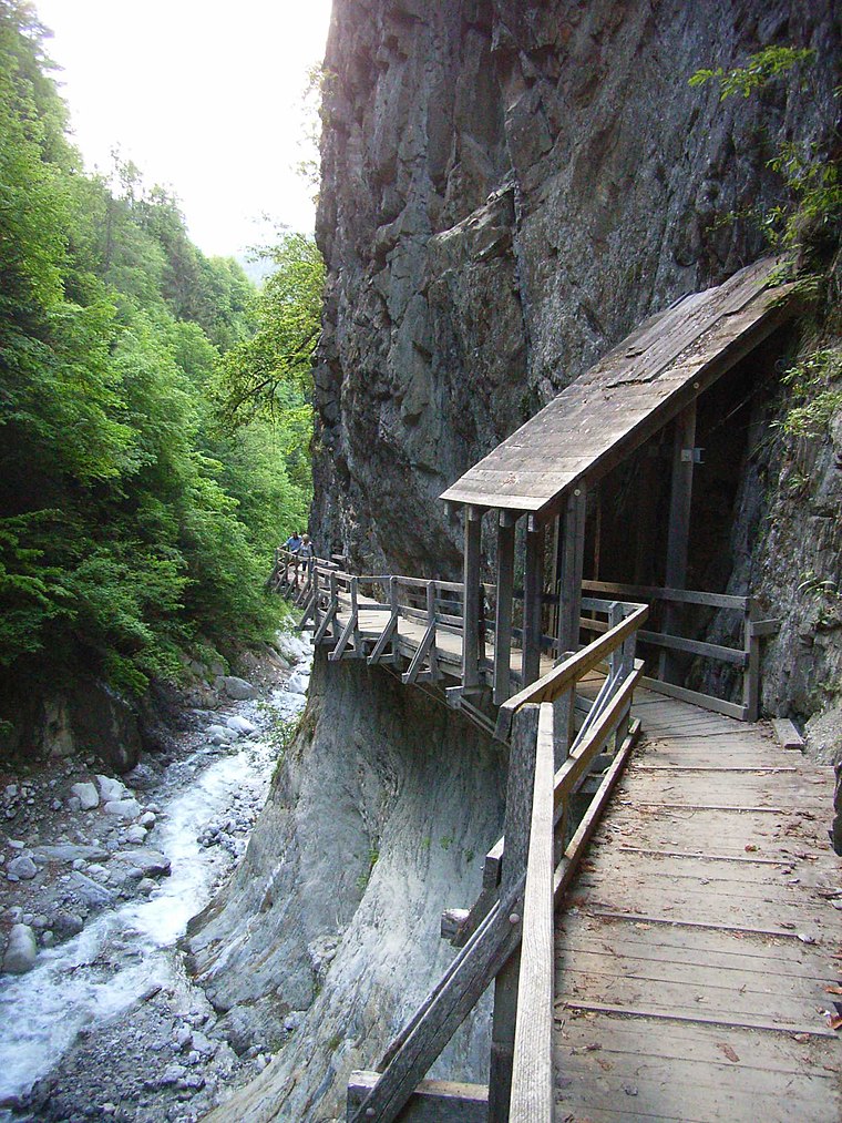
Photo: Lysippos, CC BY-SA 2.0 de.
Bovernier is a municipality in the district of Martigny in the canton of Valais in Switzerland. Bovernier is situated 3 km east of Les Pâles-Plan Cerisier.
Les Pâles-Plan Cerisier
- Type: Hamlet
- Category: locality
- Location: Martigny-Combe, Martigny District, Valais, Switzerland, Central Europe, Europe
- View on OpenStreetMap
Latitude
46.08693° or 46° 5′ 13″ northLongitude
7.04909° or 7° 2′ 57″ eastOpen location code
8FR932PX+QJOpenStreetMap ID
node 2357252961OpenStreetMap feature
place=hamlet
This page is based on OpenStreetMap, Wikidata, and Wikimedia Commons.
We’d love your help improving our open data sources. Thank you for contributing.
Satellite Map
Discover Les Pâles-Plan Cerisier from above in high-definition satellite imagery.
Localities in the Area
Explore places such as Le Perrey and La Crette.
Notable Places Nearby
Highlights include Mazot-Musée and Poste 1921 Martigny-Croix.
Valais: Must-Visit Destinations
Delve into Sion, Zermatt, Martigny, and Brig.
Curious Hamlets to Discover
Uncover intriguing hamlets from every corner of the globe.
About Mapcarta. Data © OpenStreetMap contributors and available under the Open Database License". Text is available under the CC BY-SA 4.0 license, except for photos, directions, and the map. Photo: Debugman, CC BY 3.0.