Bumgardner Branch #60
Bumgardner Branch #60 is a campsite in Swain, North Carolina. Bumgardner Branch #60 is situated nearby to the peak Sunkota Ridge, as well as near the waterfall Tom Branch.| Tap on a place to explore it |
Places in the Area
Nearby places include Bryson City and Cherokee.
Bryson City
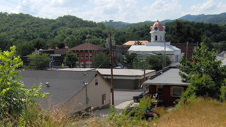
Photo: BrineStans, CC BY 3.0.
Bryson City is a small city located in the Mountains of North Carolina. The city is located near the eastern entrance of Great Smoky Mountains National Park.
Cherokee

Photo: Jan Kronsell, CC BY-SA 3.0.
Cherokee is a town in the North Carolina Mountains within the Qualla Boundary, the proper name of the Cherokee Indian reserve.
Bumgardner Branch #60
- Type: Campsite
- Also known as: “Backcountry Camp 60, Bumgardner Branch”
- Categories: tourism and camping
- Location: Swain, North Carolina, South, United States, North America
- View on OpenStreetMap
Latitude
35.49302° or 35° 29′ 35″ northLongitude
-83.42728° or 83° 25′ 38″ westElevation
2,021 feet (616 metres)Operator
National Park ServiceOpen location code
867RFHVF+63OpenStreetMap ID
node 2361010317OpenStreetMap feature
tourism=camp_site
This page is based on OpenStreetMap, Wikidata, and Wikimedia Commons.
We’d love your help improving our open data sources. Thank you for contributing.
Satellite Map
Discover Bumgardner Branch #60 from above in high-definition satellite imagery.
Notable Places Nearby
Highlights include Laney Cemetery and Indian Creek Falls.
Nearby Places
Explore places such as McCracken Branch #59 and Nick’s Nest Branch #58.
North Carolina: Must-Visit Destinations
Delve into Charlotte, Raleigh, Asheville, and Greensboro.
Curious Campsites to Discover
Uncover intriguing campsites from every corner of the globe.
About Mapcarta. Data © OpenStreetMap contributors and available under the Open Database License". Text is available under the CC BY-SA 4.0 license, except for photos, directions, and the map. Photo: southernfoodwaysalliance, CC BY 2.0.