Clarendon Hills
Clarendon Hills is a railway stop in DuPage County, Illinois. Clarendon Hills is situated nearby to Lions Park, as well as near Community Presbyterian Church.| Tap on a place to explore it |
Places of Interest Nearby
Highlights include Clarendon Hills station and West Hinsdale station.
Clarendon Hills station
Railway station

Photo: David Wilson, CC BY 2.0.
Clarendon Hills is a station on Metra's BNSF Line in Clarendon Hills, Illinois. The station is 18.3 rail miles from Chicago Union Station, the east end of Metra service on this line. Clarendon Hills station is situated 530 feet west of Clarendon Hills.
West Hinsdale station
Railway station

Photo: David Wilson, CC BY 2.0.
West Hinsdale is one of three stations on Metra's BNSF Line in Hinsdale, Illinois. The station is 17.8 miles from Union Station, the eastern terminus of the line. West Hinsdale station is situated 1,600 feet east of Clarendon Hills.
Hinsdale station
Railway station

Photo: Teemu08, CC BY-SA 3.0.
Hinsdale is one of three stations on Metra's BNSF Line in Hinsdale, Illinois, and the only one open daily. The station is 16.9 miles from Union Station, the east end of the line. Hinsdale station is situated 1¼ miles east of Clarendon Hills.
Places in the Area
Nearby places include Clarendon Hills and Hinsdale.
Clarendon Hills
Village
Photo: Wikimedia, Public domain.
Clarendon Hills is a village in DuPage County, Illinois, United States. The population was 8,702 at the 2020 census. It is a south-west suburb of Chicago.
Hinsdale
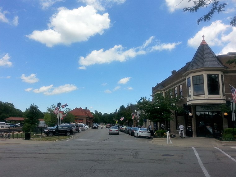
Photo: Dennisyerger84, CC BY-SA 4.0.
Hinsdale is a village in DuPage County, Illinois, United States, with a small portion in Cook County. It is one of the wealthiest communities in Illinois and in the United States.
Westmont
Town

Photo: Teemu08, CC BY-SA 3.0.
Westmont is a village in DuPage County, Illinois, United States. It is a southwest suburb of Chicago.
Clarendon Hills
- Type: Railway stop
- Categories: transport stop and transportation
- Location: DuPage County, Illinois, Midwest, United States, North America
- View on OpenStreetMap
Latitude
41.79786° or 41° 47′ 52″ northLongitude
-87.95072° or 87° 57′ 3″ westNetwork
MetraOpen location code
86HJQ2XX+4POpenStreetMap ID
node 237901403OpenStreetMap feature
public_transport=stop_positionOpenStreetMap feature
railway=stop
This page is based on OpenStreetMap, Wikidata, and Wikimedia Commons.
We’d love your help improving our open data sources. Thank you for contributing.
Satellite Map
Discover Clarendon Hills from above in high-definition satellite imagery.
Places with the Same Name
Discover other places named “Clarendon Hills”.
Notable Places Nearby
Highlights include Lions Park and Clarendon Hills Public Library.
Nearby Places
Explore places such as Clarendon Hills Train Station and Domino’s.
Illinois: Must-Visit Destinations
Delve into Chicago, Springfield, Rockford, and Loop.
Curious Railway Stops to Discover
Uncover intriguing railway stops from every corner of the globe.
About Mapcarta. Data © OpenStreetMap contributors and available under the Open Database License". Text is available under the CC BY-SA 4.0 license, except for photos, directions, and the map. Photo: Rastapopulous, CC BY-SA 3.0.