Steinbruckerkurve
Steinbruckerkurve is a bus stop in Trebesing, Spittal an der Drau District, Carinthia. Steinbruckerkurve is situated nearby to the church Evangelische Kirche Altersberg, as well as near Pfarrkirche hl. Lucia, Altersberg, Trebesing.| Tap on a place to explore it |
Places of Interest Nearby
Highlights include Evangelische Kirche Altersberg and Pfarrkirche hl. Lucia, Altersberg, Trebesing.
Evangelische Kirche Altersberg
Church

Photo: Naturpuur, CC BY-SA 4.0.
Evangelische Kirche Altersberg is a church, which is situated 520 metres west of Steinbruckerkurve.
Pfarrkirche hl. Lucia, Altersberg, Trebesing
Church

Photo: Mefusbren69, Public domain.
Pfarrkirche hl. Lucia, Altersberg, Trebesing is a church, which is situated 720 metres northwest of Steinbruckerkurve.
Burg Sommeregg
Castle
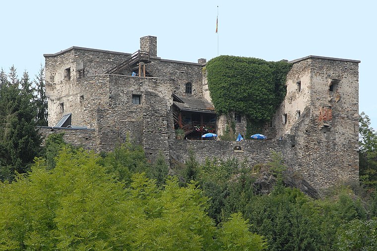
Photo: Johann Jaritz, CC BY-SA 3.0 at.
Sommeregg is a medieval castle near Seeboden in the Austrian state of Carinthia, Austria. It is situated in the foothills of the Nock Mountains at an altitude of 749 m. Burg Sommeregg is situated 3 km southeast of Steinbruckerkurve.
Places in the Area
Nearby places include Seeboden am Millstätter See and Spittal an der Drau.
Seeboden am Millstätter See
Town

Photo: Hfst, CC BY-SA 4.0.
Seeboden am Millstätter See is a market town in Spittal an der Drau District in Carinthia, Austria. Seeboden am Millstätter See is situated 4½ km southeast of Steinbruckerkurve.
Spittal an der Drau

Photo: JJ55, Public domain.
Spittal an der Drau is a town in the western part of the Austrian federal state of Carinthia. It is the administrative centre of Spittal an der Drau District, Austria's second largest district by area.
Gmünd
Town

Photo: DerFussi, CC BY-SA 3.0.
Gmünd in Kärnten is a municipality and historic town in the district of Spittal an der Drau, in the Austrian state of Carinthia. Gmünd is situated 7 km northeast of Steinbruckerkurve.
Steinbruckerkurve
- Type: Bus stop
- Category: transportation
- Location: Trebesing, Spittal an der Drau District, Carinthia, Austria, Central Europe, Europe
- View on OpenStreetMap
Latitude
46.8543° or 46° 51′ 16″ northLongitude
13.49694° or 13° 29′ 49″ eastOpen location code
8FRMVF3W+PQOpenStreetMap ID
node 2424550694OpenStreetMap feature
highway=bus_stopOpenStreetMap feature
public_transport=platform
This page is based on OpenStreetMap, Wikidata, and Wikimedia Commons.
We’d love your help improving our open data sources. Thank you for contributing.
Satellite Map
Discover Steinbruckerkurve from above in high-definition satellite imagery.
Notable Places Nearby
Highlights include Freiwillige Feuerwehr Altersberg and Hangbrücke Altersberg.
Nearby Places
Explore places such as Steinbruckerkurve and Nicklbauerbrücke.
Carinthia: Must-Visit Destinations
Delve into Klagenfurt, Villach, Wörthersee, and Spittal an der Drau.
Curious Bus Stops to Discover
Uncover intriguing bus stops from every corner of the globe.
About Mapcarta. Data © OpenStreetMap contributors and available under the Open Database License". Text is available under the CC BY-SA 4.0 license, except for photos, directions, and the map. Photo: Wikimedia, CC BY-SA 3.0.