Veyrier-Ecole
Veyrier-Ecole is a bus stop in Veyrier, Geneva. Veyrier-Ecole is situated nearby to the public building Salle Communale, as well as near Place du Tibet.| Tap on a place to explore it |
Places of Interest Nearby
Highlights include Church of Saint-Maurice, Veyrier and Jewish cemetery of Veyrier.
Church of Saint-Maurice, Veyrier
Church

Photo: Franck.schneider, CC BY-SA 3.0.
Church of Saint-Maurice, Veyrier is situated 250 metres east of Veyrier-Ecole.
Jewish cemetery of Veyrier
Cemetery
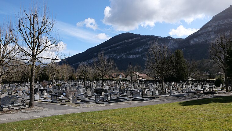
Photo: RomanDeckert, CC BY-SA 4.0.
Jewish cemetery of Veyrier is situated 520 metres northeast of Veyrier-Ecole.
Gare Basse du Téléphérique du Salève

Photo: Wikimedia, CC BY-SA 4.0.
Gare Basse du Téléphérique du Salève is situated 710 metres southeast of Veyrier-Ecole.
Places in the Area
Nearby places include Sierne and Conches.


Thônex
Town

Photo: mpd01605, CC BY-SA 2.0.
Thônex is a municipality of the Canton of Geneva, Switzerland. It is situated in the east of the canton and shares a border with the French town of Ambilly. Thônex is situated 2½ km northeast of Veyrier-Ecole.
Veyrier-Ecole
- Type: Bus stop
- Categories: transport stop and transportation
- Location: Veyrier, Geneva, Canton of Geneva, Switzerland, Central Europe, Europe
- View on OpenStreetMap
Latitude
46.16763° or 46° 10′ 4″ northLongitude
6.18316° or 6° 10′ 59″ eastElevation
419 metres (1,375 feet)Operator
TPGNetwork
UniresoOpen location code
8FR8559M+37OpenStreetMap ID
node 2426674372OpenStreetMap feature
highway=bus_stopOpenStreetMap feature
public_transport=stop_position
This page is based on OpenStreetMap, Wikidata, and Wikimedia Commons.
We’d love your help improving our open data sources. Thank you for contributing.
Satellite Map
Discover Veyrier-Ecole from above in high-definition satellite imagery.
Notable Places Nearby
Highlights include Salle Communale and Place du Tibet.
Nearby Places
Explore places such as Veyrier, école and Clinique du Grand-Salève.
Switzerland: Must-Visit Destinations
Delve into Zurich, Berne, Geneva, and Basel.
Curious Bus Stops to Discover
Uncover intriguing bus stops from every corner of the globe.
About Mapcarta. Data © OpenStreetMap contributors and available under the Open Database License". Text is available under the CC BY-SA 4.0 license, except for photos, directions, and the map. Photo: Markus Bernet, CC BY-SA 2.5.