Rocafesa
Rocafesa is a peak in Sant Martí de Llémena, Girona, Catalonia and has an elevation of 631 metres. Rocafesa is situated nearby to the locality Can Font, as well as near la Brolla d’en Sala.| Tap on a place to explore it |
Places of Interest
Highlights include Clot de l’Omera volcano and Santa Maria d’Elena.


Castell de Granollers de Rocacorba
Castle
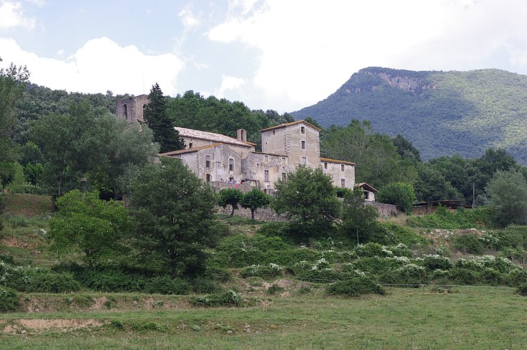
Photo: Àlex, CC BY-SA 3.0.
Castell de Granollers de Rocacorba is a castle.
Places in the Area
Nearby places include Amer and Canet d’Adri.
Amer

Photo: Wikimedia, CC BY-SA 3.0.
Amer is a town and municipality of 2,400 people in Girona province, and is a stage in Catalan Way of St. James. At the northeastern end of the La Selva region, the municipality extends throughout the entire lower Brugent valley.
Canet d’Adri
Village

Photo: Aracelifoto, CC BY-SA 3.0.
Canet d'Adri is a village in the province of Girona and autonomous community of Catalonia, Spain. The municipality covers an area of 44.30 square kilometres and the population in 2014 was 644.

Rocafesa
- Type: Peak with an elevation of 631 metres
- Category: landform
- Location: Sant Martí de Llémena, Girona, Catalonia, Eastern Spain, Spain, Iberia, Europe
- View on OpenStreetMap
Latitude
42.0421° or 42° 2′ 32″ northLongitude
2.668° or 2° 40′ 5″ eastElevation
631 metres (2,070 feet)Open location code
8FJ42MR9+R6OpenStreetMap ID
node 2440365608OpenStreetMap feature
natural=peak
This page is based on OpenStreetMap, Wikidata, and Wikimedia Commons.
We’d love your help improving our open data sources. Thank you for contributing.
Satellite Map
Discover Rocafesa from above in high-definition satellite imagery.
In Other Languages
“Rocafesa” goes by many names.
- Catalan: “Rocafesa”
Localities in the Area
Explore places such as Can Font and la Brolla d’en Sala.
Notable Places Nearby
Highlights include Esquei and El Castellet.
Girona: Must-Visit Destinations
Delve into Girona, Figueres, Llivia, and Lloret de Mar.
Curious Peaks to Discover
Uncover intriguing peaks from every corner of the globe.
About Mapcarta. Data © OpenStreetMap contributors and available under the Open Database License". Text is available under the CC BY-SA 4.0 license, except for photos, directions, and the map. Photo: Wikimedia, CC0.