Hundert-Morgen-Wald
Hundert-Morgen-Wald is a kindergarten in Floridsdorf, Vienna which is located on Pilzgasse. Hundert-Morgen-Wald is situated nearby to the health club Mrs.Sporty Club Wien-Donaufeld, as well as near the arts center Arbeitsplatz Wien.| Tap on a place to explore it |
Places of Interest Nearby
Highlights include Wien Floridsdorf railway station and St. Leopold’s Church, Donaufeld.
Wien Floridsdorf railway station
Railway station
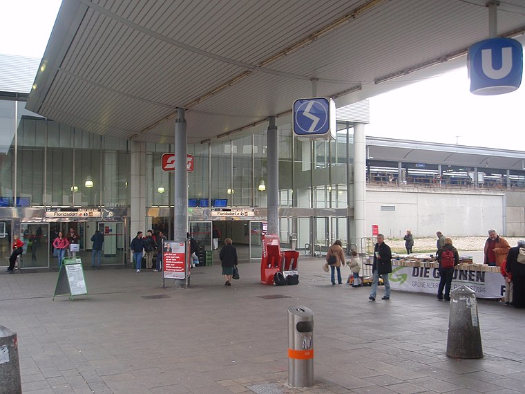
Photo: My Friend, CC BY-SA 3.0.
Wien Floridsdorf is a railway station located in the Floridsdorf district of Vienna, Austria. Opened in 1961, it is owned and operated by the Austrian Federal Railways, and is served by both regional and S-Bahn trains. Wien Floridsdorf railway station is situated 720 metres southwest of Hundert-Morgen-Wald.
St. Leopold’s Church, Donaufeld
Church

Photo: Bwag, CC BY-SA 4.0.
Saint Leopold's Church is the Roman Catholic parish church of Donaufeld in Floridsdorf, the 21st district of Vienna, Austria. Located at Kinzerplatz, it stands at a height of 96 m, which makes it the third tallest church in Vienna. St. Leopold’s Church, Donaufeld is situated 680 metres south of Hundert-Morgen-Wald.
Marktamtsmuseum Wien
Museum

Photo: H.Wolfgang, CC BY-SA 4.0.
Marktamtsmuseum Wien is situated 630 metres northwest of Hundert-Morgen-Wald.
Places in the Area
Nearby places include Outer East and Bruckhaufen.
Outer East

Photo: D.W., Public domain.
Outer East describes the Vienna districts Floridsdorf and Donaustadt.


Hundert-Morgen-Wald
- Type: Kindergarten
- Address: Pilzgasse 36/3, Wien, 1210
- Category: education
- Location: Floridsdorf, Vienna, Austria, Central Europe, Europe
- View on OpenStreetMap
Latitude
48.25895° or 48° 15′ 32″ northLongitude
16.4089° or 16° 24′ 32″ eastOpen location code
8FWR7C55+HHOpenStreetMap ID
node 2447967310OpenStreetMap feature
amenity=kindergarten
This page is based on OpenStreetMap, Wikidata, and Wikimedia Commons.
We’d love your help improving our open data sources. Thank you for contributing.
Satellite Map
Discover Hundert-Morgen-Wald from above in high-definition satellite imagery.
Notable Places Nearby
Highlights include Mrs.Sporty Club Wien-Donaufeld and Arbeitsplatz Wien.
Nearby Places
Explore places such as Luke Roberts and Del-Missier.
Vienna: Must-Visit Destinations
Delve into Innere Stadt, Vienna International Airport, Inner East, and Alsergrund.
Curious Kindergartens to Discover
Uncover intriguing kindergartens from every corner of the globe.
About Mapcarta. Data © OpenStreetMap contributors and available under the Open Database License". Text is available under the CC BY-SA 4.0 license, except for photos, directions, and the map. Photo: Jebulon, CC0.