John Ames Mitchell watering trough
John Ames Mitchell watering trough is a historic site in Town of Ridgefield, Western Connecticut Planning Region, Connecticut. John Ames Mitchell watering trough is situated nearby to the nature reserve Hayes Lane Open Space, as well as near Lewis Drive Open Space.| Tap on a place to explore it |
Places of Interest Nearby
Highlights include Keeler Tavern and Aldrich Contemporary Art Museum.
Keeler Tavern
Museum

Photo: Rolfmueller, CC BY-SA 3.0.
The Keeler Tavern is an 18th-century historical building at 152 Main Street in the center of Ridgefield, Connecticut, United States. The property served as summer home to architect Cass Gilbert, who purchased it in 1907 and designed additions to the building as well as a garden. Keeler Tavern is situated 2,500 feet northeast of John Ames Mitchell watering trough.
Aldrich Contemporary Art Museum
Museum
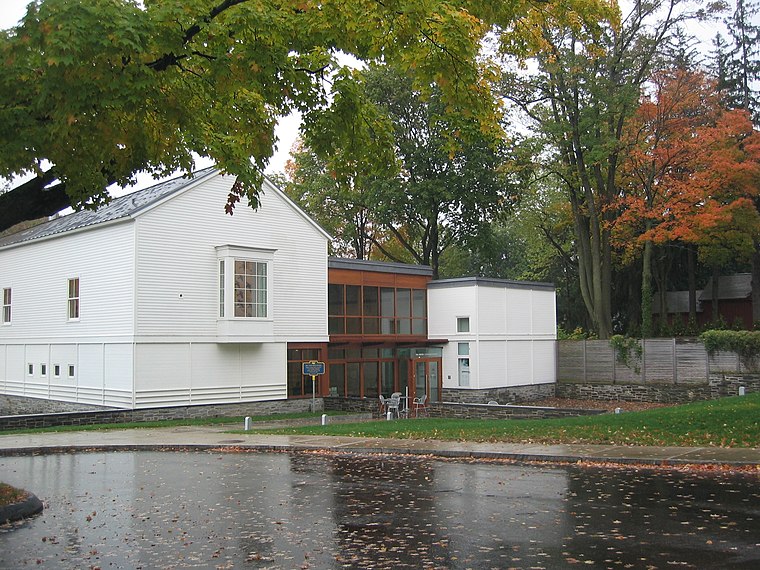
Photo: Robacols, CC BY-SA 3.0.
The Aldrich Contemporary Art Museum is located in Ridgefield, Connecticut. The Aldrich has no permanent collection and is the only museum in Connecticut that is dedicated solely to the exhibition of contemporary art. Aldrich Contemporary Art Museum is situated 3,600 feet northeast of John Ames Mitchell watering trough.
Prospector Theater
Movie theater
 Prospector Theater is a movie theater, which is situated 1 mile north of John Ames Mitchell watering trough.
Places in the Area
Nearby places include Ridgefield and Lewisboro.
Ridgefield
 Ridgefield is a town in Fairfield County, Connecticut, United States. Situated in the foothills of the Berkshire Mountains and on the New York state border, Ridgefield had a population of 25,033 as of the 2020 census.
Lewisboro

Photo: Magicpiano, CC BY-SA 4.0.
Lewisboro is a town of about 12,000 residents in northern Westchester County, about 40 miles north of New York City in the state of New York.
South Salem
Village
South Salem is a hamlet in the Town of Lewisboro, Westchester County, in the U.S. state of New York. Part of the New York metropolitan area, the town center has a post office, town hall, library, and recycling center. South Salem is situated 3 miles west of John Ames Mitchell watering trough.
John Ames Mitchell watering trough
- Type: Historic site
- Categories: tourist attraction and tourism
- Location: Town of Ridgefield, Western Connecticut Planning Region, Connecticut, New England, United States, North America
- View on OpenStreetMap
Latitude
41.26789° or 41° 16′ 4″ northLongitude
-73.50214° or 73° 30′ 8″ westOpen location code
87H87F9X+54OpenStreetMap ID
node 2468336139OpenStreetMap feature
historic=yes
This page is based on OpenStreetMap, Wikidata, and Wikimedia Commons.
We’d love your help improving our open data sources. Thank you for contributing.
Satellite Map
Discover John Ames Mitchell watering trough from above in high-definition satellite imagery.
Notable Places Nearby
Highlights include Hayes Lane Open Space and Lewis Drive Open Space.
Nearby Places
Explore places such as West Lane Pizza & Deli and West Lane Inn.
Connecticut: Must-Visit Destinations
Delve into Hartford, New Haven, Bridgeport, and Stamford.
Curious Historic Sites to Discover
Uncover intriguing historic sites from every corner of the globe.
About Mapcarta. Data © OpenStreetMap contributors and available under the Open Database License". Text is available under the CC BY-SA 4.0 license, except for photos, directions, and the map. Photo: Wikimedia, CC0.