Plan de randonnés
Plan de randonnés is in Montcresson, Arrondissement of Montargis, Centre-Val de Loire. Plan de randonnés is situated nearby to the church Église Saint-Léger de Montcresson, as well as near the library Relais point lecture.| Tap on a place to explore it |
Places of Interest Nearby
Highlights include Église Saint-Léger de Montcresson and Château de la Forêt.
Église Saint-Léger de Montcresson
Church

Photo: Klaeiis, CC BY-SA 3.0.
Église Saint-Léger de Montcresson is a church.
Château de la Forêt
Castle

Photo: Croquant, Public domain.
Château de la Forêt is a castle, which is situated 1½ km southeast of Plan de randonnés.
Chenevières amphitheatre
Archaeological site

Photo: Basicdesign, CC BY-SA 3.0.
Chenevières amphitheatre is an archaeological site, which is situated 4 km south of Plan de randonnés.
Places in the Area
Nearby places include Montbouy and Château-Renard.
Montbouy
Village
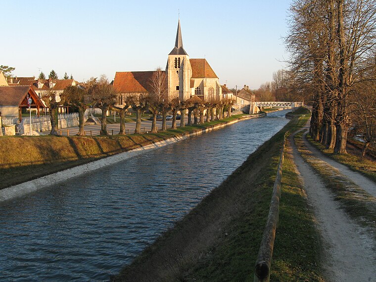
Photo: Alvaro, CC BY-SA 3.0.
Montbouy is a commune in the Loiret department in north-central France. Montbouy is situated 5 km south of Plan de randonnés.
Château-Renard
Village

Photo: Basicdesign, CC BY-SA 3.0.
Château-Renard is a commune in the Loiret department in north-central France. Château-Renard is situated 9 km east of Plan de randonnés.
Châtillon-Coligny
Village

Photo: Alvaro, CC BY-SA 3.0.
Châtillon-Coligny is a commune in the Loiret department in north-central France. The Loing and the Briare Canal run through the town. Châtillon-Coligny is situated 10 km south of Plan de randonnés.
Plan de randonnés
- Type: Map
- Categories: information and tourism
- Location: Montcresson, Arrondissement of Montargis, Loiret, Centre-Val de Loire, France, Europe
- View on OpenStreetMap
Latitude
47.90626° or 47° 54′ 23″ northLongitude
2.80723° or 2° 48′ 26″ eastOpen location code
8FV4WR44+GVOpenStreetMap ID
node 2537184803OpenStreetMap feature
tourism=information
This page is based on OpenStreetMap, Wikidata, and Wikimedia Commons.
We’d love your help improving our open data sources. Thank you for contributing.
Satellite Map
Discover Plan de randonnés from above in high-definition satellite imagery.
Notable Places Nearby
Highlights include Relais point lecture and Mairie de Moncresson.
Nearby Places
Explore places such as Restaurant de Montcresson Pizzeria and stèle du Marechal Mac Mahon.
Centre-Val de Loire: Must-Visit Destinations
Delve into Orléans, Tours, Chartres, and Bourges.
Curious Places to Discover
Uncover intriguing places from every corner of the globe.
About Mapcarta. Data © OpenStreetMap contributors and available under the Open Database License". Text is available under the CC BY-SA 4.0 license, except for photos, directions, and the map. Photo: PMRMaeyaert, CC BY-SA 3.0.