Suhadolnik
Suhadolnik is a parking area in Municipality of Preddvor, Slovenia and has an elevation of 880 metres. Suhadolnik is situated nearby to the peak Vrh, as well as near Kogel.| Tap on a place to explore it |
Places of Interest Nearby
Highlights include Grintovec and Kočna.
Grintovec
Peak
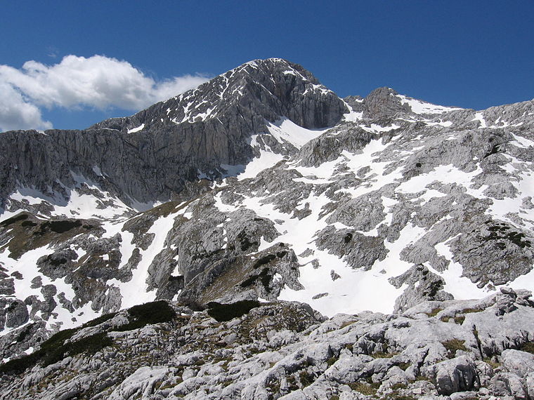
Photo: JakobZ, CC BY-SA 3.0.
Grintovec is the highest mountain of the Kamnik–Savinja Alps, with an elevation of 2,558 metres. It is a popular location for hiking, climbing and skiing. Grintovec is situated 3 km northeast of Suhadolnik.
Kočna
Peak

Photo: Borut Kantuser, CC BY-SA 3.0.
Kočna at 2,540 metres high, is the second-highest mountain in the Kamnik–Savinja Alps and the westernmost peak of the Grintovec Range. Its prominent and easily recognized peak is visible from far around. Kočna is situated 3 km north of Suhadolnik.
Kalška gora
Peak

Photo: Borut Kantuser, CC BY-SA 3.0.
Kalška gora is a peak, which is situated 3 km east of Suhadolnik.
Places in the Area
Nearby places include Kokra and Kalce Ridge.
Kokra
Village

Photo: Doremo, CC BY-SA 4.0.
Kokra is a settlement scattered along a 10-kilometer stretch of the road from Kranj to Jezersko Peak in the Kokra Valley in the Municipality of Preddvor in the Upper Carniola region of Slovenia.
Kalce Ridge
Locality

Photo: Wikimedia, CC BY-SA 3.0.
The Kalce Ridge is a 2,224-metre-high mountain of the Kamnik–Savinja Alps in northern Slovenia. It is the highest peak of the Krvavec Group.
Štefanja Gora
Village

Photo: Sl-Ziga, Public domain.
Štefanja Gora is a village in the Municipality of Cerklje na Gorenjskem in the Upper Carniola region of Slovenia. The local church is dedicated to Saint Stephen and was originally built around 1132. Štefanja Gora is situated 6 km southwest of Suhadolnik.
Suhadolnik
- Type: Parking area
- Parking: surface
- Category: transportation
- Location: Municipality of Preddvor, Slovenia, Central Europe, Europe
- View on OpenStreetMap
Latitude
46.33521° or 46° 20′ 7″ northLongitude
14.51024° or 14° 30′ 37″ eastElevation
880 metres (2,887 feet)Open location code
8FRP8GP6+33OpenStreetMap ID
node 2538398637OpenStreetMap feature
amenity=parkingOpenStreetMap attribute
parking=surface
This page is based on OpenStreetMap, Wikidata, and Wikimedia Commons.
We’d love your help improving our open data sources. Thank you for contributing.
Satellite Map
Discover Suhadolnik from above in high-definition satellite imagery.
Places with the Same Name
Discover other places named “Suhadolnik”.
Notable Places Nearby
Highlights include Vrh and Kogel.
Nearby Places
Explore places such as Suhadolnik and Kokra kamnolom.
Slovenia: Must-Visit Destinations
Delve into Ljubljana, Maribor, Koper, and Celje.
Curious Parking Areas to Discover
Uncover intriguing parking areas from every corner of the globe.
About Mapcarta. Data © OpenStreetMap contributors and available under the Open Database License". Text is available under the CC BY-SA 4.0 license, except for photos, directions, and the map. Photo: Jjtkk, CC BY 3.0.