Réti halastavak
Réti halastavak is a locality in Komárom-Esztergom County, Central Transdanubia. Réti halastavak is situated nearby to the locality Fényesdűlő, as well as near Fényes források TT.| Tap on a place to explore it |
Places of Interest
Highlights include Tata Castle and Kuny Domokos Museum.
Tata Castle
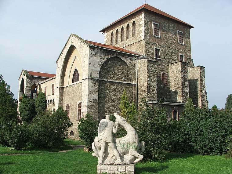 Tata Castle, built at the mid 14th-century on the northern tip of Lake Öreg, is one of the jewels of Tata, Hungary. Its blooming can be dated to the reign of Sigismund of Luxembourg and Mátyás Hunyadi as the summer resort of the king and a favoured residence.


Places in the Area
Nearby places include Tata and Szomód.
Tata
Town

Photo: Barry dinning, CC BY 3.0.
Tata is a town in Komárom-Esztergom County, northwestern Hungary, 9 km northwest of the county town Tatabánya.
Szomód
Village

Photo: Amba, CC BY-SA 3.0.
Szomód is a village in Komárom-Esztergom county, Hungary. Szomód is situated 4 km northeast of Réti halastavak.
Baj
Village

Photo: Wikimedia, CC BY-SA 4.0.
Baj is a village in Komárom-Esztergom county, Hungary. Baj is situated 4½ km east of Réti halastavak.
Réti halastavak
- Type: Locality
- Location: Komárom-Esztergom County, Central Transdanubia, Hungary, Central Europe, Europe
- View on OpenStreetMap
Latitude
47.65764° or 47° 39′ 28″ northLongitude
18.30635° or 18° 18′ 23″ eastOpen location code
8FVWM854+3GOpenStreetMap ID
node 2544954523OpenStreetMap feature
place=locality
This page is based on OpenStreetMap, Wikidata, and Wikimedia Commons.
We’d love your help improving our open data sources. Thank you for contributing.
Satellite Map
Discover Réti halastavak from above in high-definition satellite imagery.
Localities in the Area
Explore places such as Fényesdűlő and Fényes források TT.
Notable Places Nearby
Highlights include Komárom-Esztergom megyei kormányhivatal növény- és talajvédelmi igazgatósága and Tatai városi piac.
Central Transdanubia: Must-Visit Destinations
Delve into Székesfehérvár, Veszprém, Dunaújváros, and Pápa.
Curious Localities to Discover
Uncover intriguing localities from every corner of the globe.
About Mapcarta. Data © OpenStreetMap contributors and available under the Open Database License". Text is available under the CC BY-SA 4.0 license, except for photos, directions, and the map. Photo: Wikimedia, CC0.