Signal du Palet
Signal du Palet is a peak in Tignes, Arrondissement of Albertville, Auvergne-Rhône-Alpes and has an elevation of 2,780 metres. Signal du Palet is situated nearby to the locality Le Grand Chanton, as well as near Plan de Janin.| Tap on a place to explore it |
Places of Interest
Highlights include Lac de Tignes and Rochers Rouges.
Lac de Tignes
Lake
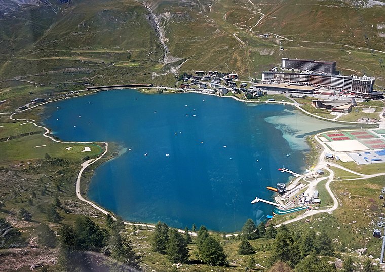
Photo: Kulmalukko, CC BY-SA 3.0.
Lac de Tignes is a lake at Tignes in the Savoie department of France.

Grande Motte
Aerial lift

Photo: Ian Gratton, CC BY 2.0.
Téléphériques de la Grande Motte is an aerial tramway in the French ski-resort Espace Killy. The tramway climbs the mountain peak with the same name in Tignes.
Signal du Palet
- Type: Peak with an elevation of 2,780 metres
- Category: landform
- Location: Tignes, Arrondissement of Albertville, Savoie, Auvergne-Rhône-Alpes, France, Europe
- View on OpenStreetMap
Latitude
45.4516° or 45° 27′ 6″ northLongitude
6.8631° or 6° 51′ 47″ eastElevation
2,780 metres (9,121 feet)Open location code
8FQ8FV27+M6OpenStreetMap ID
node 2548567087OpenStreetMap feature
natural=peak
This page is based on OpenStreetMap, Wikidata, and Wikimedia Commons.
We’d love your help improving our open data sources. Thank you for contributing.
Satellite Map
Discover Signal du Palet from above in high-definition satellite imagery.
Localities in the Area
Explore places such as Le Grand Chanton and Plan de Janin.
Notable Places Nearby
Highlights include Col de la Croix des Frêtes and Aiguille Noire de Pramecou.
Savoie: Must-Visit Destinations
Delve into Chambéry, Aix-les-Bains, Val-d’Isère, and Bourg-Saint-Maurice.
Curious Peaks to Discover
Uncover intriguing peaks from every corner of the globe.
About Mapcarta. Data © OpenStreetMap contributors and available under the Open Database License". Text is available under the CC BY-SA 4.0 license, except for photos, directions, and the map. Photo: Inkey, CC BY 2.0.