Tossal de la Palanca
Tossal de la Palanca is a peak in Estaràs, Lleida, Catalonia and has an elevation of 641 metres. Tossal de la Palanca is situated nearby to the hamlet Vergós Guerrejat, as well as near the locality Pla de la Barba.| Tap on a place to explore it |
Places of Interest
Highlights include Castell de Vergós Guerrejat and Santa Maria Magdalena de Vergós Guerrejat.
Castell de Vergós Guerrejat
Castle

Photo: Isidre blanc, CC BY-SA 4.0.
Castell de Vergós Guerrejat is a castle.
Santa Maria Magdalena de Vergós Guerrejat
Church

Photo: Angela Llop, CC BY-SA 2.0.
Santa Maria Magdalena de Vergós Guerrejat is a church.
Sant Pere de Montfalcó Murallat
Church

Photo: Wikimedia, CC BY-SA 3.0.
Sant Pere de Montfalcó Murallat is a church.
Places in the Area
Nearby places include Cervera and Les Oluges.
Cervera
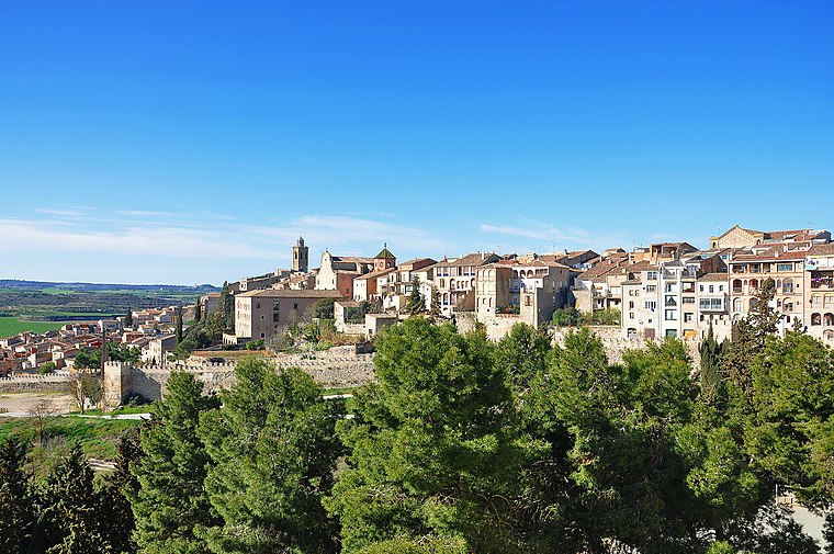
Photo: Alberto-g-rovi, CC BY 3.0.
Cervera is a town of 9,000 people in Lleida province, and a stage in the Catalan Way of St. James. The city is characterized by the richness of its cultural and monumental heritage.
Les Oluges
Village

Photo: Wikimedia, CC BY-SA 3.0.
Les Oluges is a village in the comarca of Segarra, in the province of Lleida and autonomous community of Catalonia, Spain. It has a population of 167.
Sant Ramon
Village

Photo: PMRMaeyaert, CC BY-SA 3.0.
Sant Ramon is a municipality in the county of Segarra, in Catalonia. It includes the villages of Gospí, Portell and Viver de Segarra. The name references Saint Raymond Nonnatus because he was born in Portell.
Tossal de la Palanca
Latitude
41.6782° or 41° 40′ 42″ northLongitude
1.3503° or 1° 21′ 1″ eastElevation
641 metres (2,103 feet)Open location code
8FH3M9H2+74OpenStreetMap ID
node 2579773779OpenStreetMap feature
natural=peakWikidata ID
Q11952781
This page is based on OpenStreetMap, Wikidata, and Wikimedia Commons.
We’d love your help improving our open data sources. Thank you for contributing.
Satellite Map
Discover Tossal de la Palanca from above in high-definition satellite imagery.
In Other Languages
From Catalan to Ladin—“Tossal de la Palanca” goes by many names.
- Catalan: “Tossal de la Palanca”
- Catalan: “Tossal dels Rams”
- Dutch: “Tossal de la Palanca”
- Ladin: “Tossal de la Palanca”
Localities in the Area
Explore places such as Vergós Guerrejat and Pla de la Barba.
Notable Places Nearby
Highlights include Plaça del Castell and Plaça del Forn.
Lleida: Must-Visit Destinations
Delve into Lleida, Val d’Aran, La Seu d’Urgell, and Aigüestortes i Estany de Sant Maurici National Park.
Curious Peaks to Discover
Uncover intriguing peaks from every corner of the globe.
About Mapcarta. Data © OpenStreetMap contributors and available under the Open Database License". Text is available under the CC BY-SA 4.0 license, except for photos, directions, and the map. Photo: Wikimedia, CC0.