Der Apfel
Der Apfel is in Schwaikheim, Rems-Murr-Kreis, Baden-Württemberg. Der Apfel is situated nearby to Obstbaummuseum Dornhau, as well as near the church Matthäus-Gemeinde.| Tap on a place to explore it |
Places of Interest Nearby
Highlights include Korber Kopf and Sörenberg.

Sörenberg
Scenic viewpoint
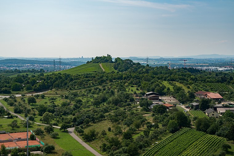
Photo: Laserlicht, CC BY-SA 4.0.
Sörenberg is a scenic viewpoint, which is situated 1½ km southwest of Der Apfel.
Evangelische Kirche Korb
Church

Photo: Megatherium, CC BY-SA 4.0.
Evangelische Kirche Korb is a church, which is situated 2 km south of Der Apfel.
Places in the Area
Nearby places include Erbachhof and Korb.

Korb
Village

Photo: Laserlicht, CC BY-SA 4.0.
Korb is a municipality in the Rems-Murr district, in Baden-Württemberg, Germany. It is located 3 km east of Waiblingen, and 15 km northeast of Stuttgart. Korb is known for the wines produced in the area.

Der Apfel
- Type: Sign
- Categories: information and tourism
- Location: Schwaikheim, Rems-Murr-Kreis, Stuttgart, Baden-Württemberg, Germany, Central Europe, Europe
- View on OpenStreetMap
Latitude
48.86123° or 48° 51′ 40″ northLongitude
9.36041° or 9° 21′ 38″ eastOpen location code
8FWFV966+F5OpenStreetMap ID
node 2580810361OpenStreetMap feature
tourism=information
This page is based on OpenStreetMap, Wikidata, and Wikimedia Commons.
We’d love your help improving our open data sources. Thank you for contributing.
Satellite Map
Discover Der Apfel from above in high-definition satellite imagery.
Places with the Same Name
Discover other places named “Der Apfel”.
Notable Places Nearby
Highlights include Obstbaummuseum Dornhau and Matthäus-Gemeinde.
Nearby Places
Explore places such as Feldgehölze und Hecken and Lebensraum Trockenmauer.
Baden-Württemberg: Must-Visit Destinations
Delve into Stuttgart, Heidelberg, Karlsruhe, and Mannheim.
Curious Places to Discover
Uncover intriguing places from every corner of the globe.
About Mapcarta. Data © OpenStreetMap contributors and available under the Open Database License". Text is available under the CC BY-SA 4.0 license, except for photos, directions, and the map. Photo: Traveler100, CC BY-SA 3.0.