Sliboň
Sliboň is a peak in Gmina Muszyna, Nowy Sącz County, Małopolskie and has an elevation of 789 metres. Sliboň is situated nearby to the locality Ždiar, as well as near Hromacka.| Tap on a place to explore it |
Photo: Wikimedia, CC BY-SA 4.0.
Places of Interest
Highlights include Żegiestów train station and Chrám sv. Michala archanjela.
Żegiestów train station
Railway station

Photo: Andrzej Błaszczak, CC BY-SA 4.0.
Żegiestów train station is a railway station.
Chrám sv. Michala archanjela
Church

Photo: Wikimedia, CC BY-SA 3.0.
Chrám sv. Michala archanjela is a church.

Places in the Area
Nearby places include Malý Lipník and Sulín.
Malý Lipník
Village
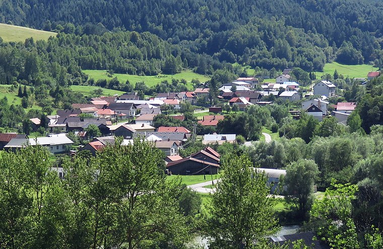
Photo: Andrzej Błaszczak, CC BY-SA 4.0.
Malý Lipník is a village and municipality in Stará Ľubovňa District in the Prešov Region of northern Slovakia.
Sulín
Village
Photo: Wikimedia, CC BY-SA 3.0.
Sulín is a village and municipality in Stará Ľubovňa District in the Prešov Region of northern Slovakia.
Matysová
Village

Photo: Fenos, CC BY-SA 3.0.
Matysová is a village and municipality in Stará Ľubovňa District in the Prešov Region of northern Slovakia.
Sliboň
- Type: Peak with an elevation of 789 metres
- Category: landform
- Location: Gmina Muszyna, Nowy Sącz County, Małopolskie, Poland, Central Europe, Europe
- View on OpenStreetMap
Latitude
49.3494° or 49° 20′ 58″ northLongitude
20.7773° or 20° 46′ 38″ eastElevation
789 metres (2,589 feet)Open location code
8GX28QXG+QWOpenStreetMap ID
node 2613405501OpenStreetMap feature
natural=peakWikidata ID
Q9338545
This page is based on OpenStreetMap, Wikidata, and Wikimedia Commons.
We’d love your help improving our open data sources. Thank you for contributing.
Satellite Map
Discover Sliboň from above in high-definition satellite imagery.
In Other Languages
“Sliboň” goes by many names.
- Polish: “Sliboń”
Localities in the Area
Explore places such as Pod Sliboňom and Ždiar.
Notable Places Nearby
Highlights include Sulínka and Miejsce Wypoczynku - Drzewo.
Małopolskie: Must-Visit Destinations
Delve into Kraków, Auschwitz-Birkenau, Oświęcim, and Zakopane.
Curious Peaks to Discover
Uncover intriguing peaks from every corner of the globe.
About Mapcarta. Data © OpenStreetMap contributors and available under the Open Database License". Text is available under the CC BY-SA 4.0 license, except for photos, directions, and the map. Photo: Wikimedia, CC BY-SA 4.0.