Carmita
Carmita is a supermarket in Buenavista del Norte, Santa Cruz de Tenerife which is located on Avenida de la Constitución. Carmita is situated nearby to the church Salón del Reino de los Testigos Cristianos de Jehová, as well as near the reservoir Depósito Los Molinos.| Tap on a place to explore it |
Places of Interest Nearby
Highlights include Iglesia de Nuestra Señora de los Remedios and Buenavista Lighthouse.
Iglesia de Nuestra Señora de los Remedios
Church

Photo: CARLOS TEIXIDOR CADENAS, CC BY 4.0.
Iglesia de Nuestra Señora de los Remedios is a church, which is situated 630 metres northwest of Carmita.
Buenavista Lighthouse
Lighthouse

Photo: Dreizung, CC BY-SA 4.0.
The Buenavista Lighthouse, also known as the Punta de Buenavista lighthouse is an active lighthouse in the municipality of Buenavista del Norte on the northern coast of Tenerife in the Canary Islands. Buenavista Lighthouse is situated 3 km northeast of Carmita.
Iglesia Nuestra Señora de La Luz
Church

Photo: THORtenerife, Public domain.
Iglesia Nuestra Señora de La Luz is a church, which is situated 3 km east of Carmita.
Places in the Area
Nearby places include El Palmar and Conjunto histórico de Los Silos.

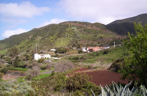
Conjunto histórico de Los Silos
Village

Photo: THORtenerife, Public domain.
Conjunto histórico de Los Silos is a village, which is situated 3 km east of Carmita.
Carmita
- Type: Supermarket
- Address: Avenida de la Constitución, Buenavista del Norte, 38480
- Categories: shop and food
- Location: Buenavista del Norte, Santa Cruz de Tenerife, Canary Islands, Spain, Iberia, Europe
- View on OpenStreetMap
Latitude
28.3679° or 28° 22′ 4″ northLongitude
-16.84775° or 16° 50′ 52″ westOpen location code
7CW59592+5WOpenStreetMap ID
node 2631138753OpenStreetMap feature
shop=supermarket
This page is based on OpenStreetMap, Wikidata, and Wikimedia Commons.
We’d love your help improving our open data sources. Thank you for contributing.
Satellite Map
Discover Carmita from above in high-definition satellite imagery.
Places with the Same Name
Discover other places named “Carmita”.
Notable Places Nearby
Highlights include Salón del Reino de los Testigos Cristianos de Jehová and Depósito Los Molinos.
Nearby Places
Explore places such as Autoescuela ‘La Luz’ and Empaquetado de plátanos COISBA.
Canary Islands: Must-Visit Destinations
Delve into Santa Cruz de Tenerife, Las Palmas, La Palma, and La Gomera.
Curious Supermarkets to Discover
Uncover intriguing supermarkets from every corner of the globe.
About Mapcarta. Data © OpenStreetMap contributors and available under the Open Database License". Text is available under the CC BY-SA 4.0 license, except for photos, directions, and the map. Photo: Wikimedia, CC BY-SA 4.0.